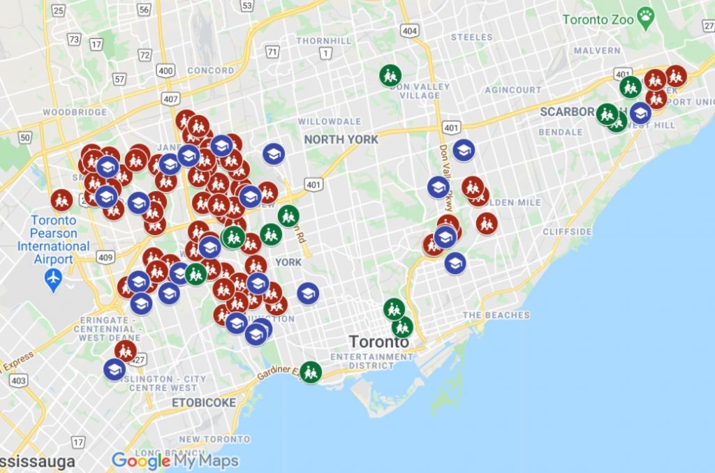
Map of Toronto schools at high-risk for coronavirus

Toronto Public Health has identified at least 80 elementary schools within the Toronto District School Board (TDSB) and 42 schools within the TCDSB that are at high-risk for the spread of COVID-19 based on the neighbourhoods they are located in.
Another 13 elementary schools in the TDSB have also been deemed to have a “class-size” risk, meaning they are in need of additional measures to lower class sizes
The areas were ranked based on neighbourhood level data that includes COVID-19 case counts combined with three key socioeconomic indicators:
Advertisement
- Percentage of the neighbourhood population that is low‐income
- Percentage of the neighbourhood population living in multigenerational homes
- Percentage of the neighbourhood population that is a visible minority
These priority hot spots will have smaller class sizes which are based on an estimated 80 per cent of students returning to in-person classes.
For example, the Junior and Senior Kindergarten classes in the schools identified by Public Health will be capped at 15 while other schools will be capped at 21.
If more than the estimated amount of students return to class, the TDSB will need to use the space being made available by the City of Toronto which includes 36 rooms in 24 facilities like community centres, libraries, museums and other cultural centres.
The board’s potential use of the space would not disrupt any city programming.
CityNews has also identified 24 TDSB high schools using the same neighbourhood data and parametres by Toronto Public Health to determine which of these schools qualify as being high-risk. The data is updated as of Sept. 4.
Advertisement
Here is a map that lists each TDSB school by location: