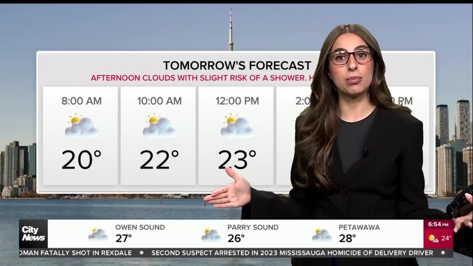
Orange-level heat warning issued for GTA; dangerous heat expected for Canada Day
Posted June 29, 2026 5:32 am.
Last Updated June 30, 2026 9:51 am.
It’s going to be a hot one as Canada Day is celebrated mid-week and July rolls in with Environment and Climate Change Canada issuing an orange level heat warning for Toronto and the GTA.
The warning was issued on Monday ahead of what the national weather agency called a “long duration heat event” that is expected to start on Tuesday, continuing through Friday and potentially into the weekend.
Orange alerts are not very common and the warnings mean the impact of the heat will be “major, widespread” and may last a few days.
CityNews chief meteorologist Natasha Ramsahai warns that heat warnings should not be ignored.
“Extreme heat is the leading weather-related cause of death globally so heat warnings should be taken seriously,” she says.
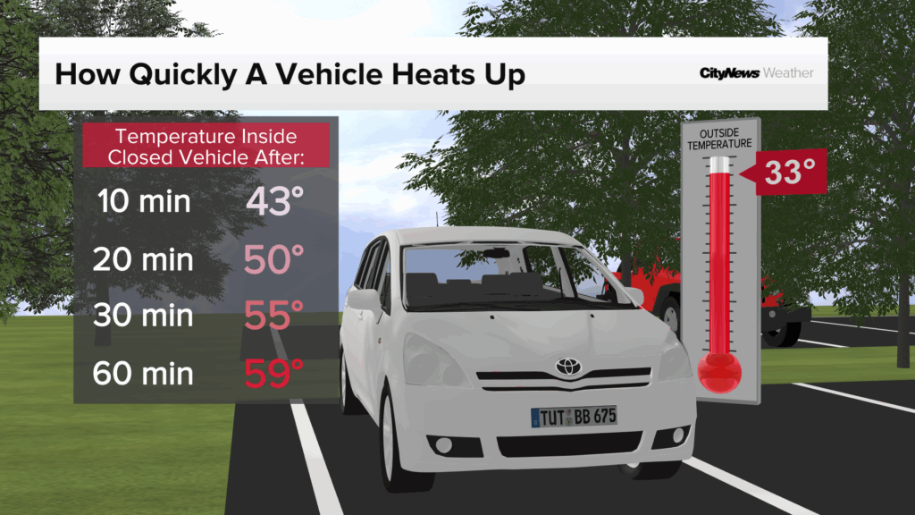
Do not leave children or pets in vehicles as internal temperatures can reach life-threatening levels within a short period of time. Remember to stay hydrated, keep curtains closed and seek out air conditioned spaces as needed. Avoid being outside during peak heat hours between 11 a.m. and 3 p.m. and take breaks to go inside if you work outdoors.
Monday’s high was somewhat bearable, a couple of degrees above average, reaching 29 C. A warm front moves in at night, triggering a risk of early morning storms on Tuesday. It also ushers in a very hot airmass and dangerously muggy conditions triggering the start of an extended heat wave.
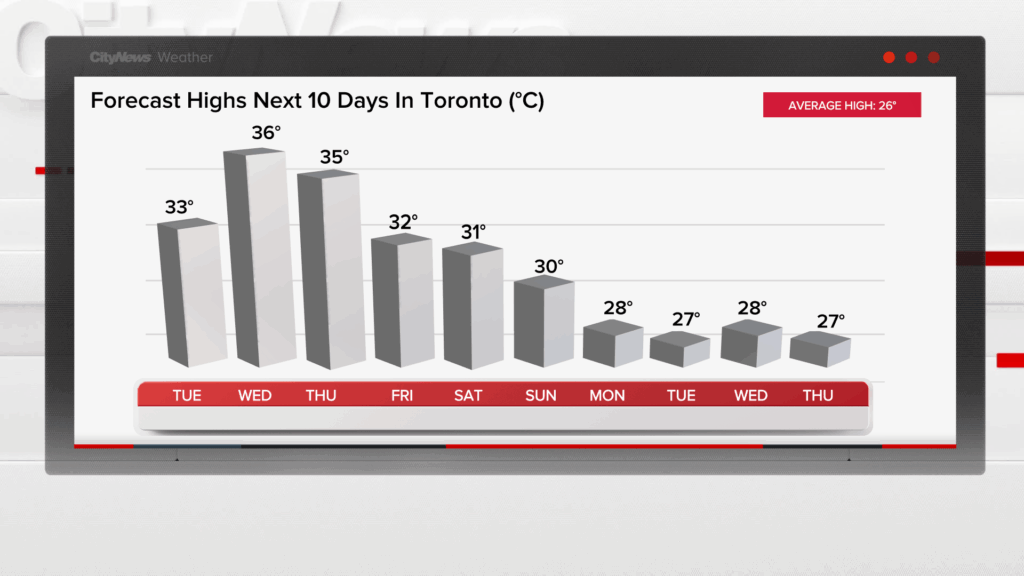
Tuesday is when you are really going to start to feel the heat with a high of 33 C and a humidex of 44. It will be very humid with sunny breaks and a risk of thunderstorm though the pre-dawn hours.
Daily maximum temperature records will be challenged this week, especially on Wednesday and Thursday.
“The hottest days are expected to be Wednesday and Thursday, with maximum temperatures of 34 to 37 degrees Celsius expected. Minimum temperatures of 21 to 25 degrees Celsius will provide little relief from the heat,” Environment Canada stated in its warning.
The national weather agency said the hot and humid air could lead to poor air quality, resulting in the Air Quality Health Index approaching the high-risk category.
The hottest temperature recorded at Pearson International Airport was 38.3 C on Aug. 25, 1948. That was in the middle of a seven-day heat wave. The next hottest day at Pearson on record was 15 years ago on July 21, 2011 when the temperature reached 37.9 C in the middle of an eight-day heat wave.
On Canada Day, you want to choose some air-conditioned celebrations as it’s going to feel close to 48 with the humidity Wednesday.
The high will reach 36 C and only drop down to 24 C overnight feeling like 34 with the humidity at the coolest point of the night. There is a chance of showers and a risk of storms throughout the afternoon as well. The storm risk clears in time for Canada Day fireworks.
There’s not much relief on Thursday and fans attending the game at Toronto Stadium will face a double whammy with both heat – an expected high of 35 C and a humidex near 46 – and thunderstorm risks in the afternoon.
The humidex is still expected to be in the low 40s on Friday with a high of 32 C and a low of 23 C.
By the weekend, there is expected to be some relief from the excessive heat with a break in the humidity and daytime high temperatures falling back to the high 20s.
With files from Dilshad Burman