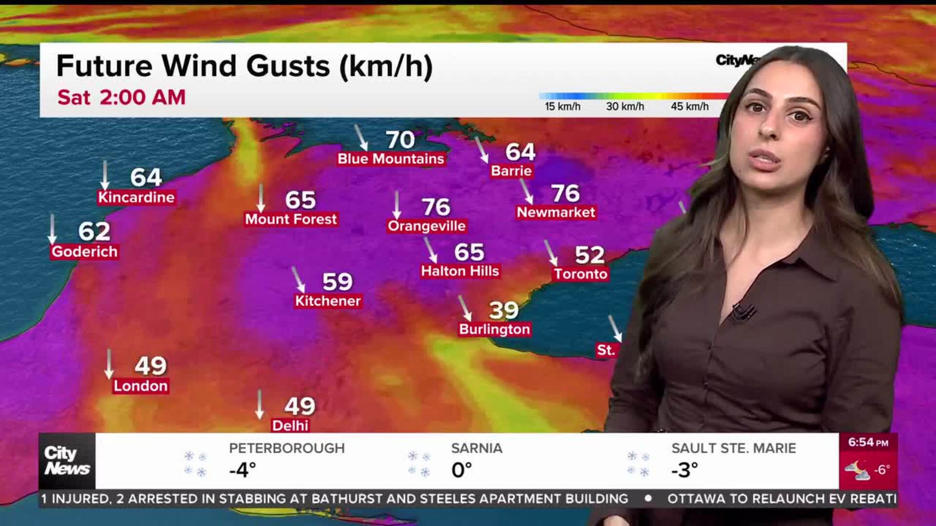
GTA Gets A Brief Break From The Cold
Posted February 20, 2007 12:00 pm.
This article is more than 5 years old.
It’s the first day in weeks that GTA residents may not have to bundle up before going outside.
Though it’s not exactly T-shirt weather, warm winds from the south are blowing through the province, bringing with them above zero temperatures. As of 7am the mercury had already climbed to 3 degrees Celsius in Toronto and it settled at 4C for a high during the day.
And though it’s only a few degrees above freezing it likely feels much warmer in comparison with the frigid conditions and bitter wind chills Ontarians have been dealing with over the past several weeks as an Arctic air mass settled over the province.
Environment Canada meteorologists suggest the mild weather will last until at least Thursday, with temperatures sticking above the freezing mark – if only by a degree or two.
After that, on Friday, the cold will return and the weekend is expected to bring temperatures closer to seasonal – between -4C and -5C. But the warmth may be back again quickly, as Sunday’s forecast currently calls for a high of 4C and potentially rising to a spring-like 8C on Monday.
A spokesperson from the national weather service admitted that the chilly weather over the past two to three weeks has been far below normal, and lasted longer than cold snaps usually do.
Northern parts of the province have also warmed by a few degrees, though they’re still below zero.
As the warmth moved in, the city of Toronto cancelled its extreme cold weather alert on Monday – it had been in effect since the weekend.
Such a warning is issued when Environment Canada calls for temperatures of -15C or lower without wind chill factored in.
For the latest weather conditions, click here.
To read Michael Kuss’s weather blog, click here.