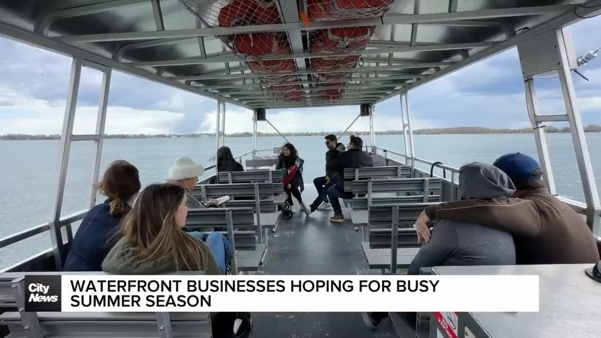
Severe Thunderstorm Hits GTA; London Tornado Warning Over
Posted May 15, 2007 12:00 pm.
This article is more than 5 years old.
It finally arrived, as advertised – those drenching downpours that Meteorologist Michael Kuss had been warning you about for days. A severe thunderstorm warning was issued for most of the GTA, including Toronto, Mississauga, Peel, Halton, Milton, Vaughan, Richmond Hill, Pickering, Uxbridge and Oakville, as well as points north, south and west. Later in the evening the warning was called off for Toronto and most of southern Ontario, but those that braved the elements earlier in the day can attest to the ferocity of the conditions. Winds gusted as high as 100 kilometres an hour in certain spots, (like at King and Bay, left) and there were prolonged periods of heavy rain. At least 15 millimetres fell in an hour in many areas. Hail as large as golf balls came down in other places.
As much as 100 millimetres of rain could fall overall, prompting the Toronto and Region Conservation Authority to issue a flood warning for creeks, rivers and streams at least until Thursday. All that water means trouble and slippery conditions on the roads and drivers are being warned to take extra precautions if they get stuck in a sudden deluge.
The effects of the storm have been felt all over the city. There were reports of wires down in numerous places and few scattered power outages. Some basements have been flooded. And all those drops and all that wind could be responsible for a slab of marble dropping off one of the top floors of First Canadian Place, as well as a major accident that caused trouble for afternoon rush commuters on the 400.
Storm sewers overflowed causing serious flooding at Jane and Dundas.
The weather has also played havoc with some flights at Pearaon International Airport. Check on the status of your plane here.
A tornado warning was out for areas near London. A weather spotter there detected the kinds of conditions that can lead to the formation of a funnel cloud and residents were being warned to stay alert and stay inside. But it was cancelled by 9pm.
The disturbance follows an amazingly sunny and warm summer day in the GTA, where temperatures reached into the middle 20s and humidex values soared to the 30s. It’s part of one of the wackiest weather days in recent memory. The city went from normal spring-like conditions to the extreme heat of Tuesday.
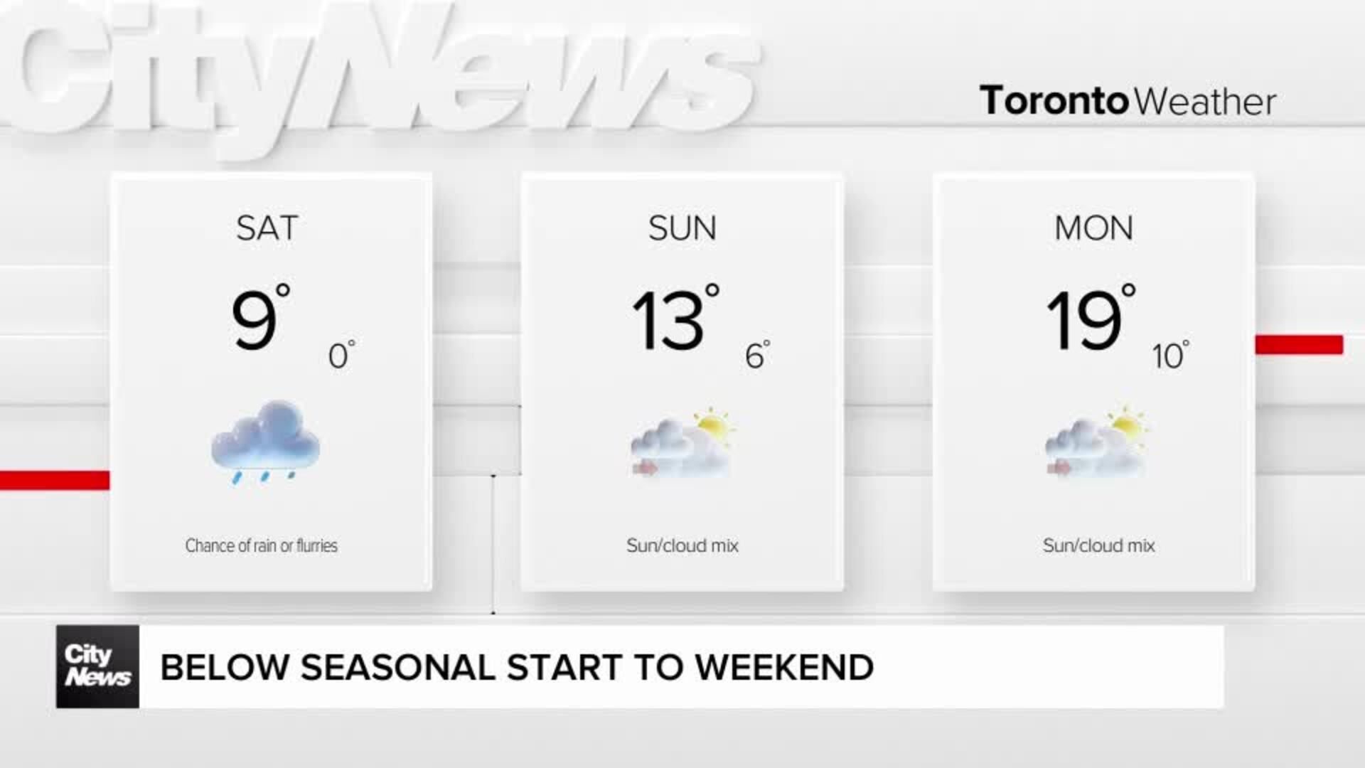
But the cold front that triggered the storm will leave a big chill in its wake. And by Thursday night, there’s a risk of frost in some areas.
The long weekend is looking OK so far, with mostly sunny daytime temperatures hitting the upper teens to low 20s. Ironically, Victoria Day is considered one of the busiest of the year for nurseries and gardening stores. But don’t be in too much of a hurry to put down roots just yet. Forecasters say we could have another risk of frost when the holiday ends on Monday night.