Rainy and cold: Toronto, GTA long-term forecast looks bleak as May arrives
Posted April 27, 2023 10:46 am.
Last Updated April 27, 2023 7:00 pm.
After one of the darkest winters in Ontario’s history, the early spring forecast in Toronto and the GTA leaves much to be desired as below-seasonal temperatures and rain appear to be the story as May begins.
It will be a chilly start to May across southern Ontario and the Golden Horseshoe, with temperatures more typical of early April and late March. Heavy rain will hit Toronto on Friday, with 15-20 mm expected to fall by the weekend’s arrival.
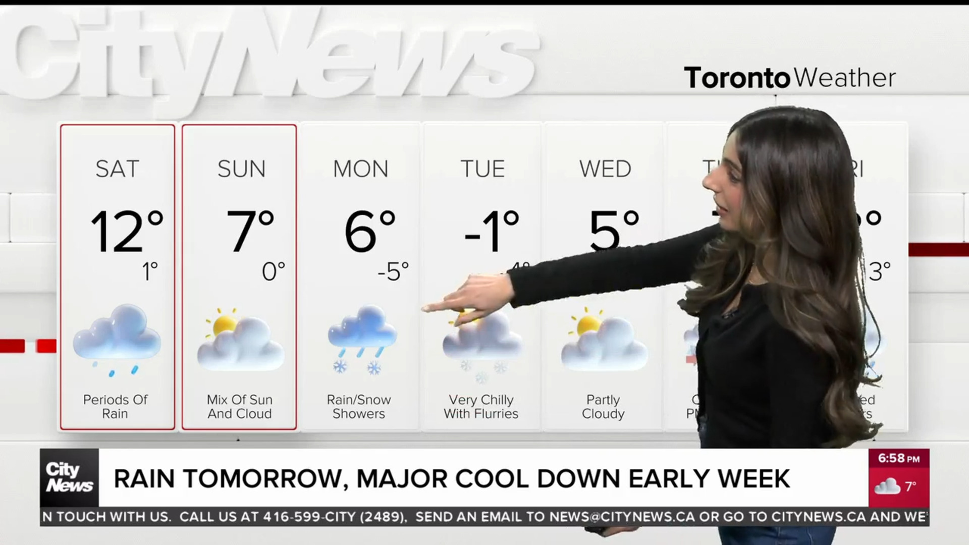
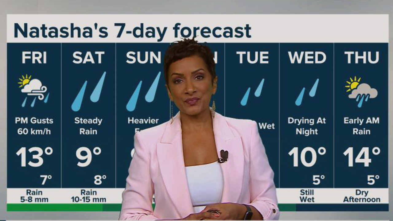
You might want to keep your weekend plans to indoor activities as Saturday is shaping up to be a wash. There’s currently a 90 per cent chance of rain, with 10-15 mm expected in the city and wind gusts reaching up to 54 km/h.
The same goes for Sunday; though rain showers will be lighter, 15 mm could fall by Monday.

CityNews weather graphic. Photo: CityNews Toronto.
Regarding weekend temperatures, Saturday and Sunday’s daytime will hover around 11 C — well below the historical average for the end of April, which is around 16 C.
It won’t get any better next week, as Monday’s daytime high is forecasted to be 9 C, though it will feel more like 6 C and be accompanied by clouds and rain showers. More rain should arrive on Tuesday, with a daytime high of 9 C and an early prediction of 5-10 mm.
Much of the same is expected in Halton-Peel, including Mississauga, Brampton, Oakville and Burlington. The City of Hamilton could see heavier rain this weekend, particularly on Sunday, with slightly warmer temperatures of 13 C but as much as 30 mm of precipitation.
While temperatures will be cooler than seasonal through the first week of May, conditions should trend closer to seasonal during the second week of the month. Though it’s early and subject to change, next Thursday looks more promising, with a high of 13 C and a mix of sun and clouds in Toronto.
Cloudy start to May comes after darkest winter in 80-plus years
While April showers bring May flowers, it’s not as easy to stomach if you consider recent data that suggested this winter was the darkest in the province in more than 80 years.
According to data compiled by Brian Brettschneider, a climate scientist with the United States National Weather Service in Alaska, he determined through the European Centre for Medium-Range Weather Forecasts that the province — particularly the Great Lakes area and Thunder Bay saw the least amount of sunlight this winter.
Brettschneider said that January was particularly dark and cloudy caused by a “high pressure over and south of Hudson Bay, extending over to the Maritime provinces.” He said February wasn’t as dreadful but close in terms of cloud coverage.
It hasn’t been all bad in April, though. There was a fantastic stretch of record-breaking, summer-like weather that graced much of the province a few weeks ago with consistent 20 C weather and sunny skies that had many embracing what felt like a sign of things to come.
While it hasn’t been as beautiful of late, data indicates that May should return to seasonal with more sun across the province after this upcoming stretch.