Thunderstorm watch ended for Toronto, GTA
Posted May 22, 2024 8:13 am.
Last Updated May 22, 2024 10:22 pm.
A thunderstorm watch has ended for Toronto and much of the GTA.
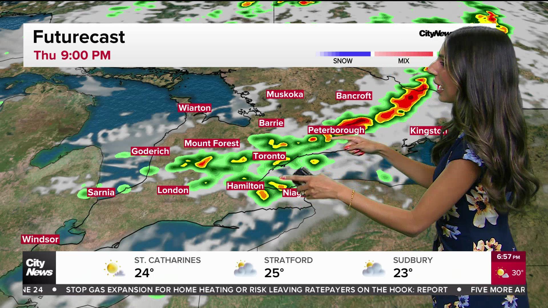
Environment Canada issued the watch for much of the region on Wednesday morning, warning of wind gusts up to 90 km/h and toonie-sized hail.
Severe weather was continuing to wreak havoc north of the GTA.
Hydro One says as of 10 p.m. it was dealing with more than 260 outages across southern Ontario affecting more than 11,000 customers, the largest of which was just outside Orillia.
”Our crews continue to respond to outages caused by damaging thunderstorms. We anticipate customers in the hardest hit areas of central and eastern Ontario to remain without power overnight,” the utility said.
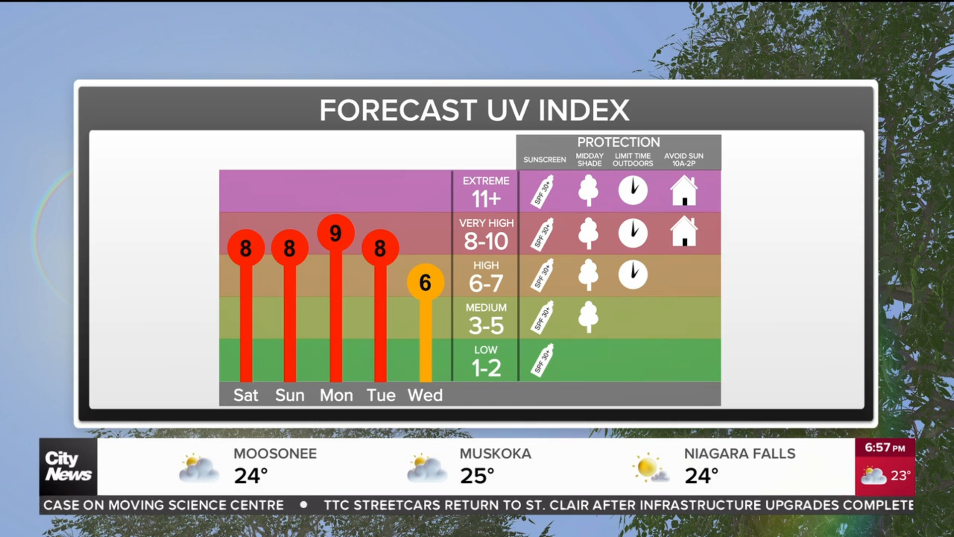
While Toronto and the GTA will experience hot daytime temperatures and humidex values on Wednesday, a cold front will squash some of that heat to cap off the week, with plenty of sunshine on the way. We’re expecting sunny skies and a high of 25 C on Thursday and Friday.
Temperatures sky-rocketed in the city on Tuesday, hitting 29 C at its peak, though it felt more like 34 C. Toronto’s average high for this time of the year is 20 C.
To sign up for the Weather Guarantee and to see the latest details on your current conditions and extended forecast, visit here.