Cooler air moves into GTA after pre-summer swelter
Posted May 19, 2026 5:25 pm.
Last Updated May 20, 2026 12:33 pm.
Noticeably cooler air has moved into the Greater Toronto Area (GTA) on Wednesday after a powerful cold front brought rain and thunderstorms late Tuesday, ending the first major heat spell of the season.
Toronto and the GTA were under a yellow heat warning on Monday and Tuesday but that was lifted just after 8 p.m. on Tuesday.
The temperature hit 30 C at Pearson International Airport two days in a row, but the mercury is expected to trend below seasonal for the rest of the week.
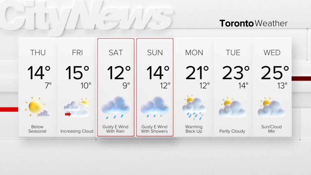
A high of 21 C has already been reached on Wednesday. The temperature will hover near 17 C for the afternoon and drop to 8 C overnight.
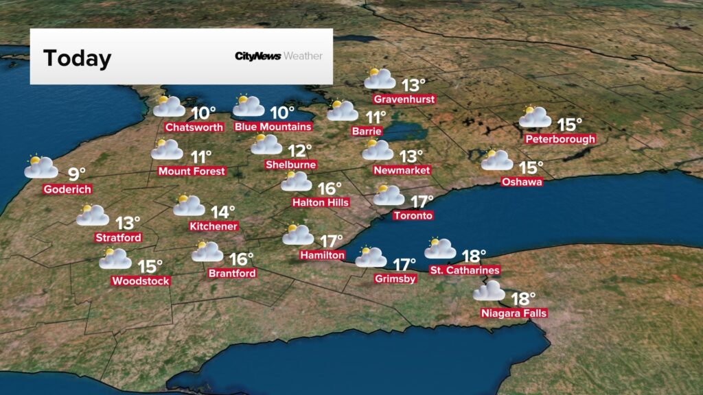
Thursday and Friday are expected to be mostly sunny with daytime highs in the mid-teens but the wind gusts will start picking up heading into a rainy weekend.
According to the latest forecast model, around five to 10 millimetres of rain is possible on Saturday with a cool high of 12 C, due in-part to gusty easterly winds blowing over the cool water of Lake Ontario.
The temperature on Sunday is expected to be slightly warmer, around 14 C, but accompanied with scattered showers.
Click here for the latest forecast.
Storm damage in London, Ont., area
The same cold front that brought relief from the heat also caused damage across parts of southwestern Ontario on Tuesday.
At point the storms were so intense they triggered tornado warnings in the area of London, Ont.
Damage including downed trees and fences were reported in the region. Investigators are working to determine if a tornado touched down. No injuries were reported.


Toronto and the GTA were under a yellow thunderstorm watch on Tuesday evening, which was lifted around 8 p.m.
However, the strongest storms were expected to remain further west along Lake Huron shorelines and into southwestern Ontario, where damaging winds and large hail were possible. Wind gusts of 82 km/h and 71 km/h were reported in Niagara Region and London, respectively.
With files from Denise Andreachi and Jaime Pulfer, 680 NewsRadio; and Michelle Mackey, CityNews