Messy mix of precipitation in Toronto, GTA for Monday
Posted March 6, 2022 9:07 pm.
Last Updated March 7, 2022 12:47 pm.
Toronto and the GTA plunged back into winter weather on following a day of double-digit springlike temperatures on Sunday.
Environment Canada has issued a winter weather travel advisory for most of southern Ontario, calling for a messy mix of precipitation on Monday that will impact both the morning and evening commutes.
“As temperatures climb above the freezing mark, especially for areas closer to Lake Ontario, precipitation will change over to rain,” says the weather agency. “Precipitation will transition to wet snow, with minimal accumulations, before ending in the evening.”
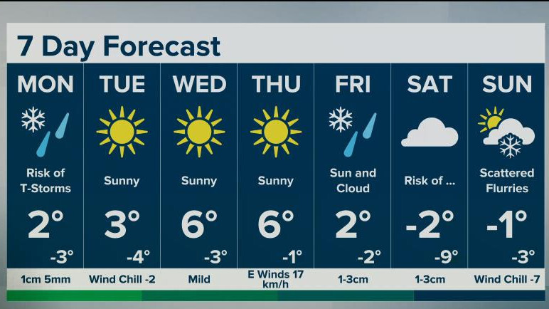
The freezing rain wrapped up around noon and wet snow is expected through the afternoon. CityNews meteorologist Jill Taylor says Toronto could see around 2 cm of snow by 6 p.m.
Good Monday morning! #Toronto GTA! Back to winter! Changeable and mixed precip this am with rain/snow, risk of freezing rain. Most of freezing rain through morning for Hamilton, Oxford,Brant
Snow for afternoon then ending around 6pm. About 2cm wet snow Toronto. 5cm north GTA— Jill Taylor (@JillTaylorCity) March 7, 2022
Temperatures are expected to hover around the freezing mark for most of the day, meaning the risk of freezing rain remains into the early afternoon as you move further away from the lakeshore.
“Motorists are advised to exercise caution and give themselves extra time to reach their destination,” says Environment Canada. “Surfaces such as highways, roads, walkways and parking lots may become icy and slippery.”
A freezing rain warning is in effect for several areas including Hamilton, Peel and Halton.
Environment Canada is calling for 2 to 4 mm of ice accumulation in those areas before the freezing rain transitions to snow or rain, possibly mixed with ice pellets, around midday.
