Severe thunderstorms possible in Durham Region, east GTA as cold front rolls through

Posted June 1, 2022 11:44 am.
Last Updated June 1, 2022 1:19 pm.
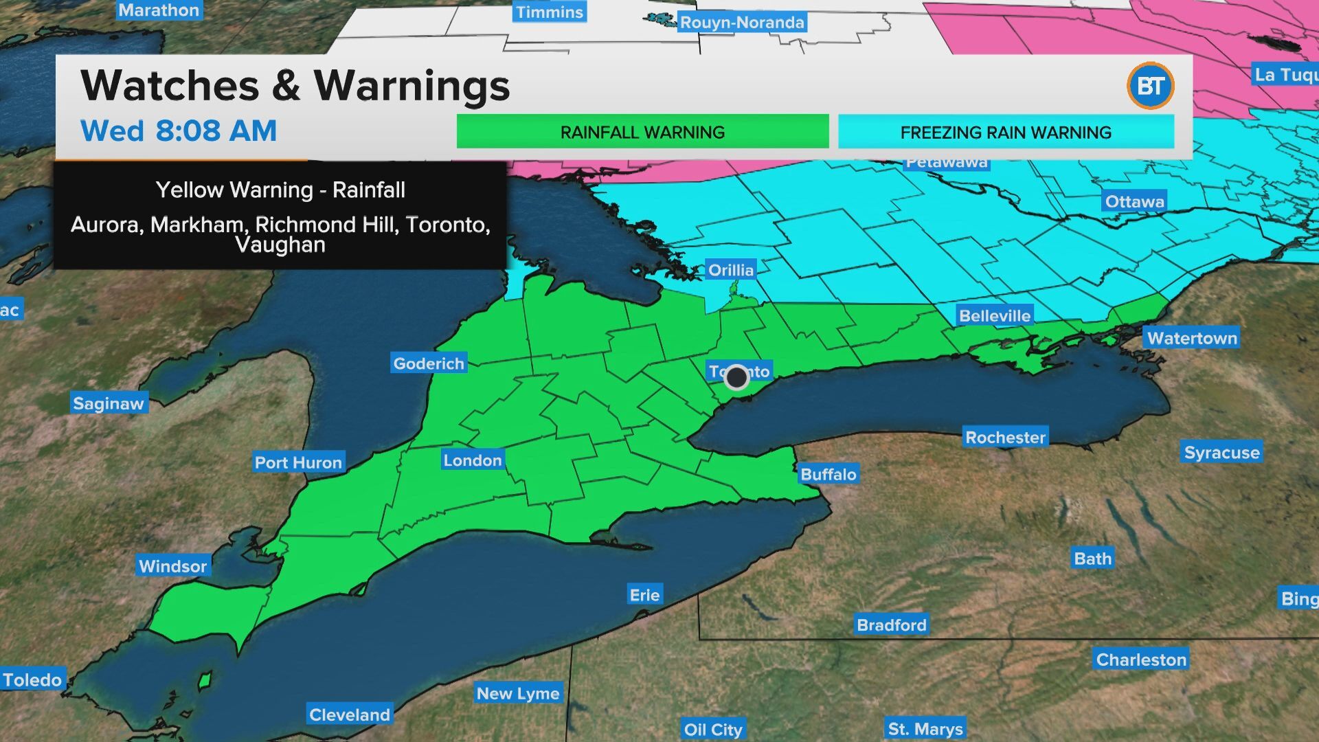
A severe thunderstorm watch is in effect for parts of Durham Region as a cold front bringing rainfall passes through the GTA on Wednesday afternoon.
Environment Canada says areas around Pickering, Oshawa, Uxbridge, and Beaverton, could see heavy rain, strong wind, and hail, beginning in the early afternoon.
“Thunderstorms have developed along a cold front and are moving towards the area,” Environment Canada says.
The agency says wind gusts of up to 90 km/hr are possible with rainfall totals of 20 to 30mm.
A thunderstorm watch is also in effect for Hamilton and the Niagara Region. Other areas of the province are under a warning (see below).

Severe thunderstorm watches and warnings across Ontario. CITYNEWS
CityNews meteorologist Carl Lam says the storms could last into the later afternoon and possibly affect the afternoon drive home.
“A number of things to watch for today, those showers and thunderstorms found just ahead of the cold front,” he says. “We do have just enough of those ingredients in place and that instability in the atmosphere to get those thunderstorms going.”
The heat and humidity that settled into the GTA over the past two days will be replace by cooler air once the cold front passes.
The city is in store for cooler temperatures overnight and a high near 19 C for Thursday.