Environment Canada warns of ‘significant snowfall’ by midweek

Posted January 22, 2023 4:30 pm.
Last Updated January 23, 2023 8:36 am.
Most of southern Ontario is under a special weather statement ahead of what Environment Canada calls “significant snowfall” by midweek.
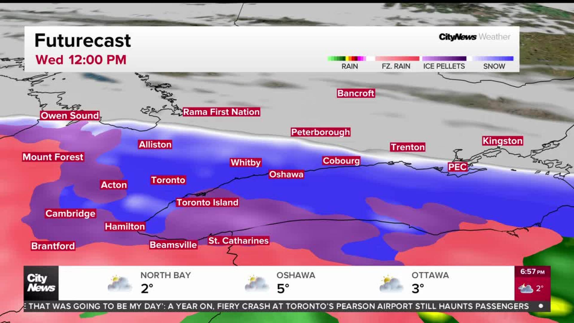
A Texas low is bringing snow to Toronto and the GTA late Wednesday and into Thursday with snowfall accumulations of between 10 to 20 centimeres possible.
“Wednesday through Thursday we have a massive storm system heading towards the Great Lakes, a lot of moisture will be packed in with this area of low pressure,” said CityNews 680 weather specialist Denise Andreacchi. “Single day snowfall totals will be higher than they’ve been for many communities so far this winter.”
Environment Canada says rapidly accumulating snow will make travel difficult with reduced visibility in heavy snow.
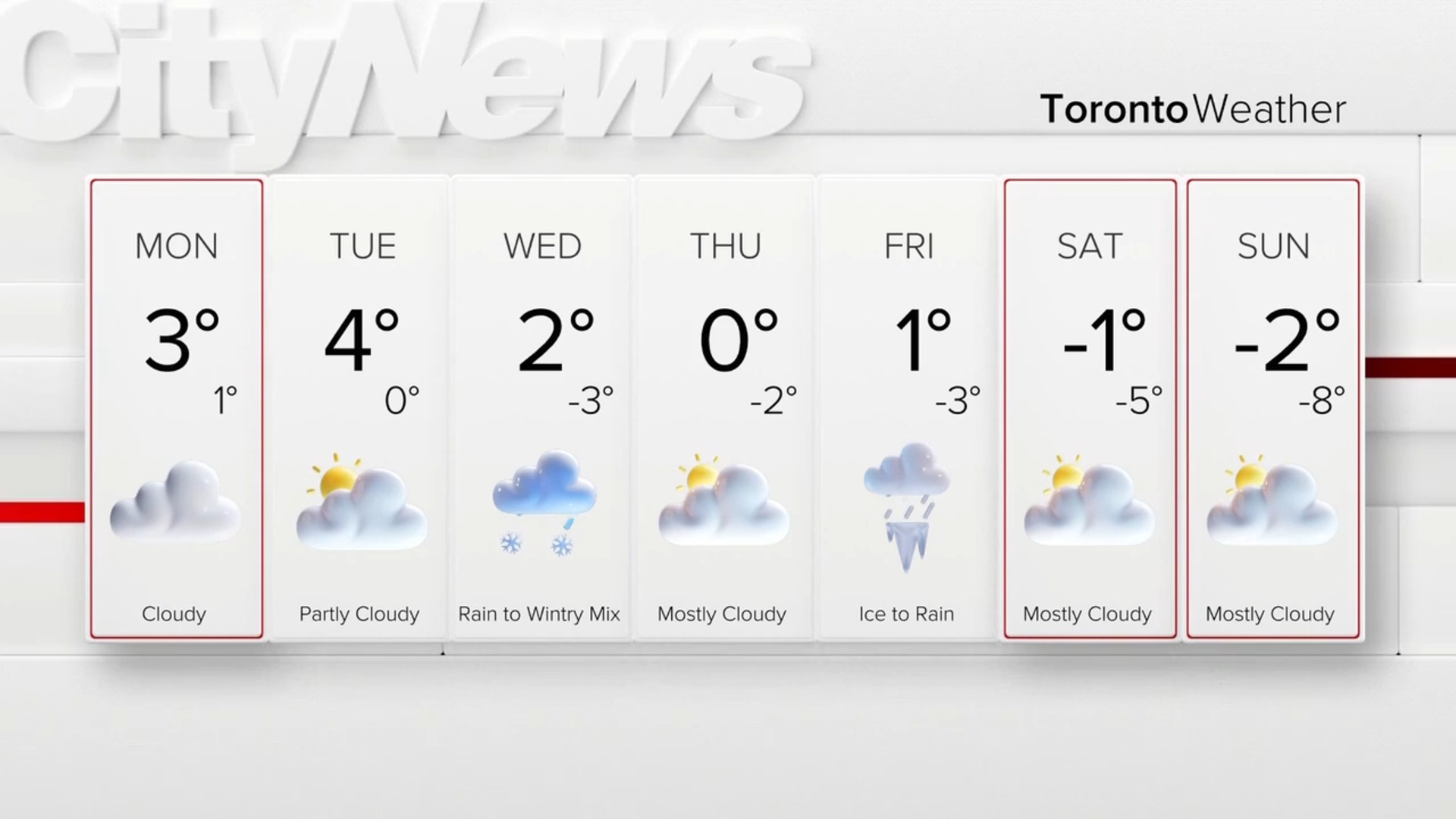
Good Monday morning! Chance of flurries today, tonight, tomorrow BUT main focus is on Wed/Thur storm. It will bring all snow. May get a quick burst of snow Wed morning with a couple of cms but the main event for Wed evening and Thurs morning 10-20cm possible #Toronto GTA
— Jill Taylor (@JillTaylorCity) January 23, 2023
“Timing wise we’re definitely going to be impacted through Wednesday evening’s drive,” added Andreacchi. “It does start through the early part of the day but really gets going through that late afternoon and early evening and will last overnight into Thursday morning.”
“Winds will be strong on Wednesday, with gusts up to 50 km/h so there will be that risk for blowing and drifting snow.”
Similar warnings are also in effect for Halton, Niagara, and Durham regions.
Andreacchi says the GTA can expect another round of flurry activity on Friday into Saturday.