Warm weather rebound for GTA will see near record-setting temps this week
Posted February 26, 2024 10:58 am.
Last Updated February 26, 2024 7:30 pm.
The GTA is in for another round of weather whiplash this week as warmer than seasonal air returns following a bone-chilling weekend.
Toronto is expected to approach record highs on Tuesday and Wednesday before a brief dip on Thursday that will be followed by yet another warm-up.
“This going to be an interesting week,” according to CityNews 680 meteorologist Jill Taylor, who says we’re in for “a pretty wild weather ride.”
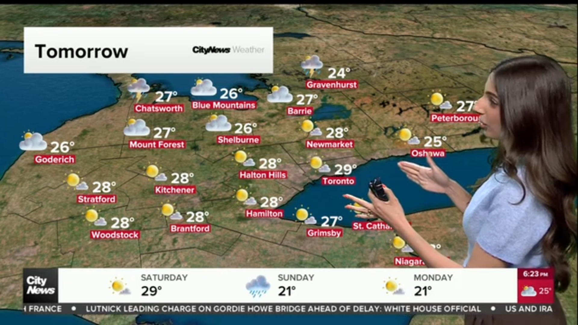
The city will see sun and cloud and a guaranteed high of 7 C on Monday before temperatures soar into the mid-teens over the next two days.
Tuesday will see a high near 13 C, just shy of the record for Feb. 27 of 14.8 C set in 2000. Wednesday will see a similar high near 14 C, close to the record of 16.2 C set in 2018.
Both Tuesday and Wednesday morning will see periods of light rain. The weather rollercoaster should continue late Wednesday with snow possible in the late afternoon and evening as cooler air returns.
“It’s a pretty wild day on Wednesday,” says Taylor. “We’ve got rain in the morning and snow possible later on. Some areas could even see some significant icing as the temperatures drop.”
Thursday will see a high around 0 C with an overnight low around -6 C.
The brief return to winter-like conditions will be followed by another warm-up with a high near 10 C on Friday. The above seasonal trend is expected to continue into next week.
Toronto saw a similar warm-up last week before temperatures plunged to around -15 C on Saturday, feeling closer to -20 with the windchill.
The current condition and extended forecast can be found here.