7.2 magnitude earthquake shakes southern Peru
Posted June 28, 2024 3:09 am.
Last Updated June 28, 2024 5:21 am.
A magnitude 7.2 earthquake shook the southern coast of Peru early Friday. Authorities say there are no immediate reports of casualties.
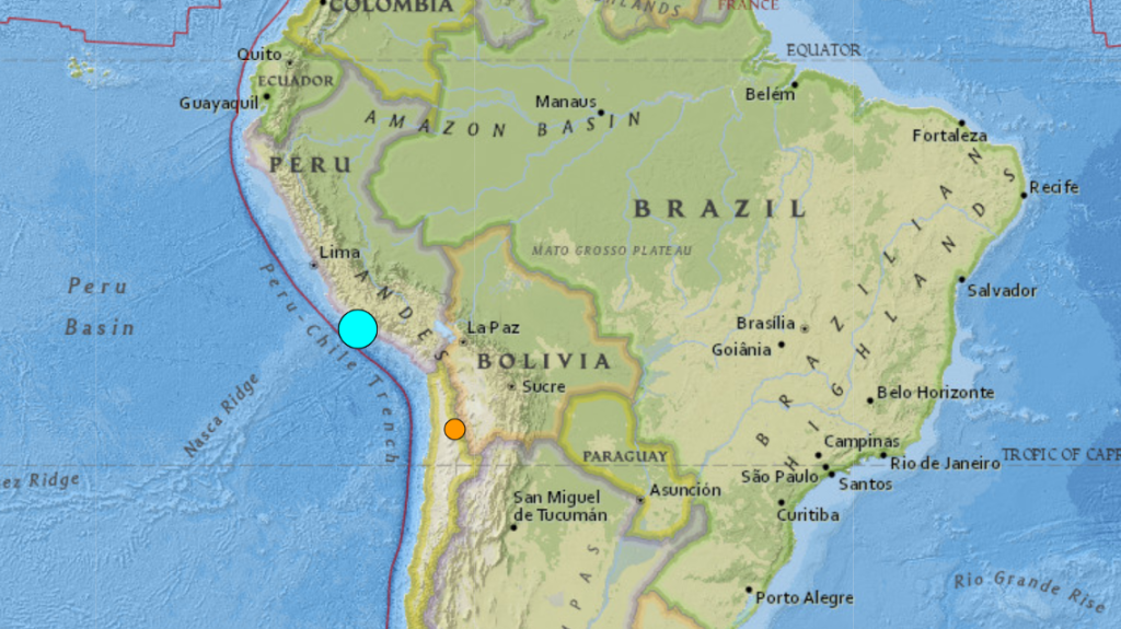
The U.S. Geological Survey said the earthquake occurred at 12:36 a.m. (0536 GMT). The epicenter was located in the Pacific Ocean, some 5 miles (8 kilometers) west of the district of Atiquipa, in the province of Caravelí. That is some 380 miles south of the capital, Lima, near the borders with Chile and Bolivia. The depth was 17 miles (28 kilometers).
The earthquake was felt in the nearby regions of Ayacucho, Ica, and the capital, local media reported. Eder Allca, the mayor of the district of Sancos, in the Ayacucho region, told the local radio station RPP that a road in his district suffered rock slides that left several localities cut off.
The Hydrography and Navigation Directorate of the Peruvian Navy reported that the seismic event generated a tsunami alert along the Peruvian coast. However, the Pacific Tsunami Warning Center in Honolulu said any threat of a tsunami had already passed.
Earthquakes are frequent in Peru, as the country is located in the Pacific “Ring of Fire.”