Rainfall warning ends for Toronto as flooding affecting some roads, TTC routes
Posted July 15, 2024 8:22 am.
Last Updated July 15, 2024 8:09 pm.
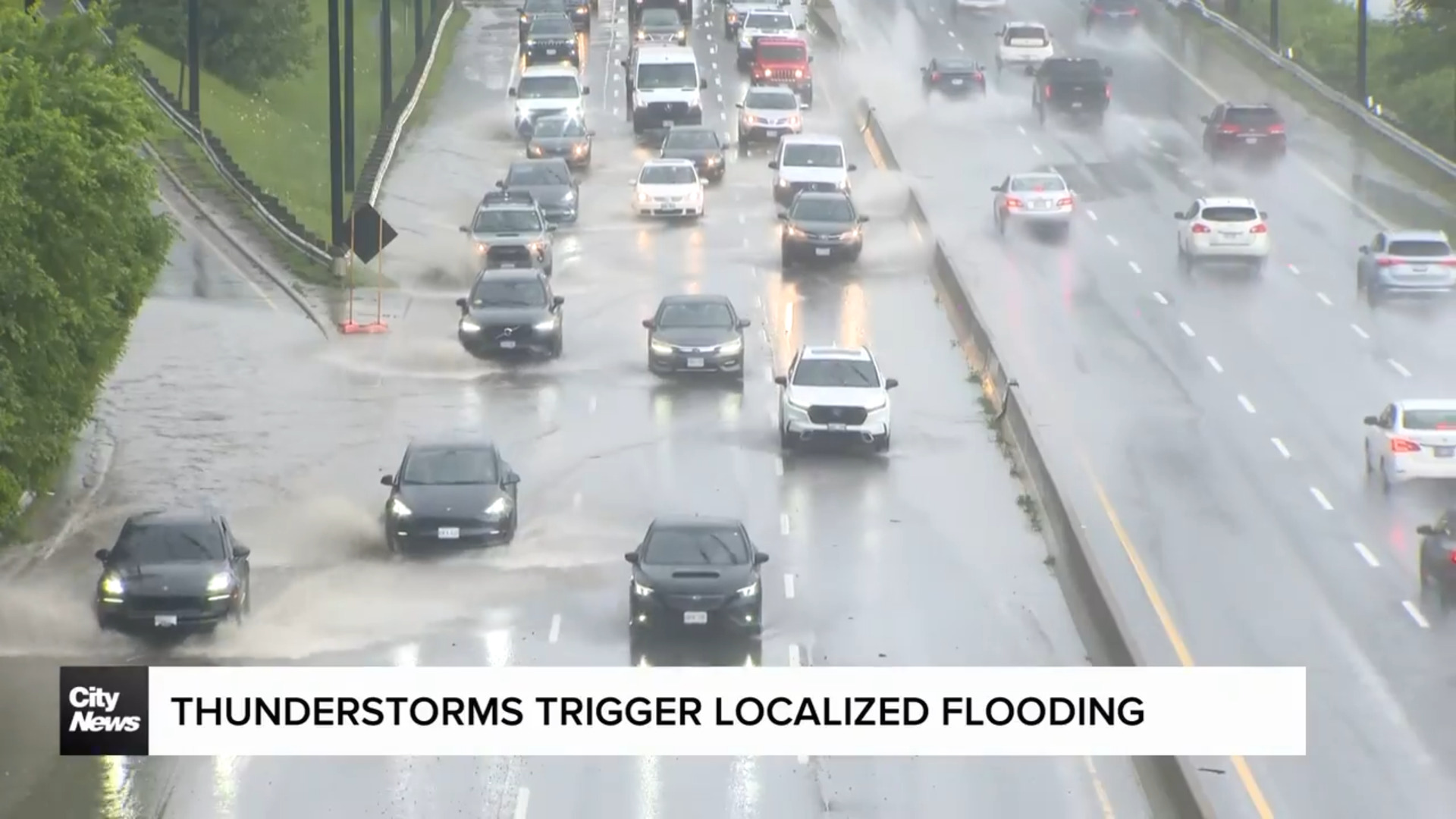
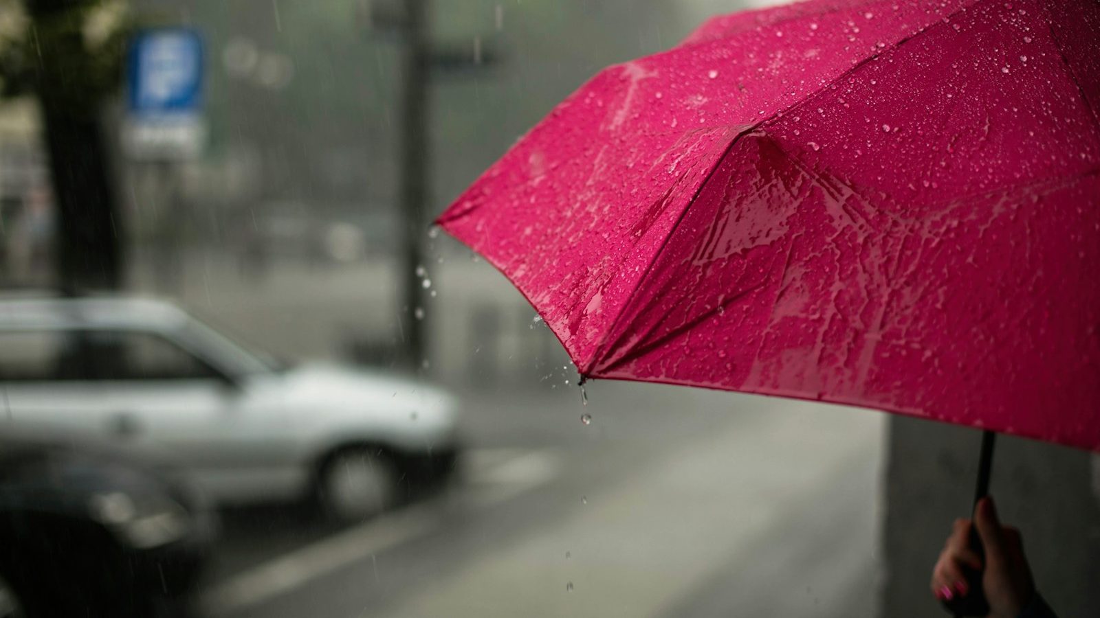
Downpours and thunderstorms have led to flooding in some areas across the GTA as rainfall warning ends for Toronto and the surrounding GTA.
Environment Canada said rainfall amounts of 40 to 60 millimetres were possible while cautioning that torrential downpours could bring 30 millimetres an hour.
In Toronto, streetcar service for route 507 Long Branch has also been paused due to flooding, but buses have been called in.
The Don Valley Parkway is also experiencing flooding at Dundas Street and along Lake Shore Boulevard at Rees St. and near Ontario Place.
Some flooding was reported in areas of Burlington earlier Monday.
“Multiple roads and intersections across Burlington have flooded, storm water systems overwhelmed, due to heavy rains. Drive carefully and remain patient while the waters recede,” a post on X from Halton Regional Police Service states.
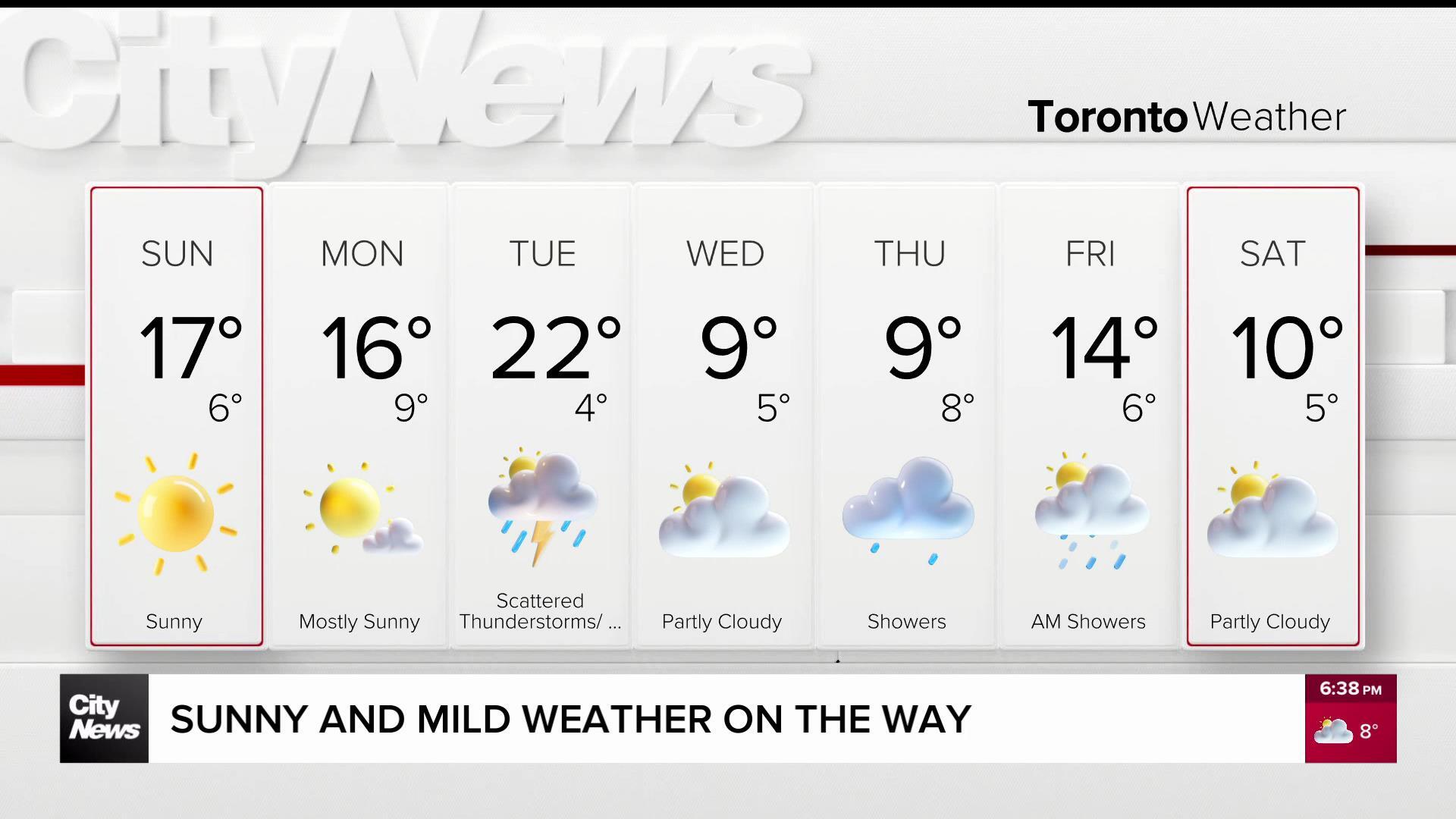
Environment Canada had previously issued a heat warning for most of southern Ontario over the weekend. That alert ended Monday afternoon but could be reissued on Tuesday, as temperatures were expected to reach 29 C and feel more like 38 at their peak when humidex values are factored in.
“A humid airmass has reached the region. Daytime maximum temperatures are expected to be near 29 C with humidex values near 40,” Environment Canada wrote in its heat warning alert for Toronto. “There will be little relief at night as minimum temperatures are expected to be near 20 C.”
Canada’s weather agency said a cooler airmass should arrive by Tuesday, alleviating much of the humidity and hot temperatures.
Forecasters are monitoring another potential thunderstorm heading into Tuesday across Toronto and southern Ontario. While the hot daytime temperatures will likely have subsided, the risk of thunderstorms will remain for Toronto on Tuesday by 10 or 11 a.m.
The skies will clear by Tuesday afternoon, and we’re expecting a daytime high of 27 C, though it will feel more like 37 with the humidex. On Tuesday evening, there’s another risk of strong thunderstorms developing in Toronto. On Wednesday, conditions will be pleasant, with a forecasted high of 26 C and a mix of sun and clouds.
For a look at your extended forecast, and to sign up for the Weather Guarantee Contest, click here.