Southern Ontario braces for most powerful winter storm of the year, up to 30 cm of snow possible
Posted February 11, 2025 6:35 am.
Last Updated February 12, 2025 6:11 pm.
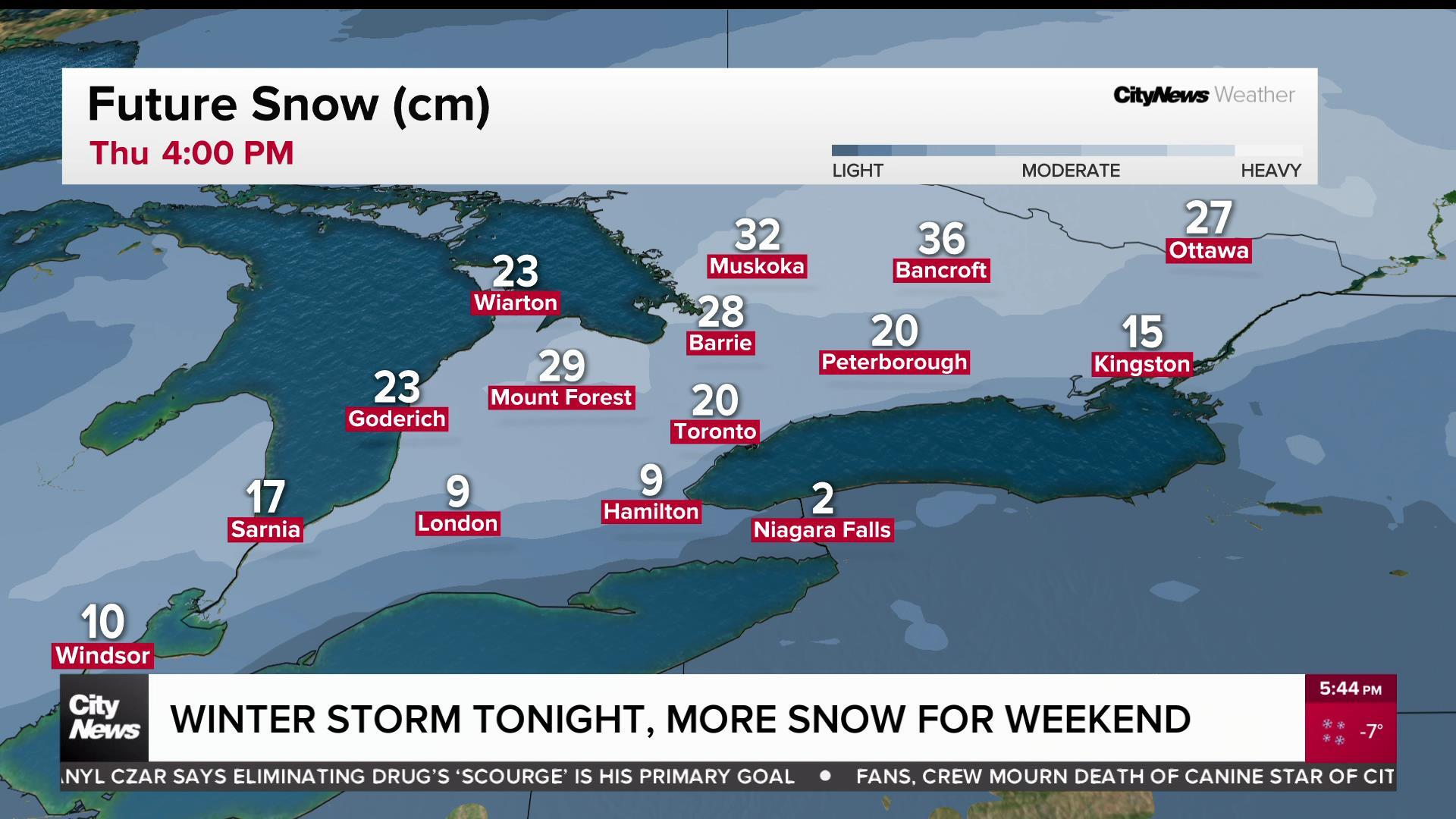
Southern Ontario is bracing for the most impactful winter storm of the year, bringing 15 to 30 cm of snow through Toronto and the GTA by Thursday morning.
A snowfall warning is in effect for Toronto and surrounding regions, warning of heavy snow and possible ice pellets.
Total snowfall amounts are expected to be near 15 cm, with peak snowfall rates of two to four centimetres per hour.
“This snowfall will impact the Wednesday evening commute. Snow may become mixed with ice pellets late Wednesday evening and overnight for some areas. Snow will gradually taper off through Thursday morning,” Environment Canada wrote in its weather alert for Toronto.
The snowfall will intensify through the evening and overnight, especially in areas north of Lake Ontario, including parts of cottage country. Snowfall rates could exceed 2 cm per hour causing reduced visibility and hazardous travel conditions.
A higher range of snowfall accumulation is forecasted across the GTA, with Toronto likely to see between 15 and 20 cm.
“There is also a risk of freezing rain in the Hamilton and Burlington areas late [Wednesday] evening and overnight,” Environment Canada added.
The heaviest snowfall, totalling 25 to 30 cm, is expected north of the GTA, extending through cottage country and into Ottawa.
The highest chance for heavy snowfall is early Thursday morning in southern and eastern Ontario, as widespread, intense snow could deliver accumulations exceeding 20 cm. Due to gusty winds up to 70-90 km/h, power outages are also possible on Thursday.
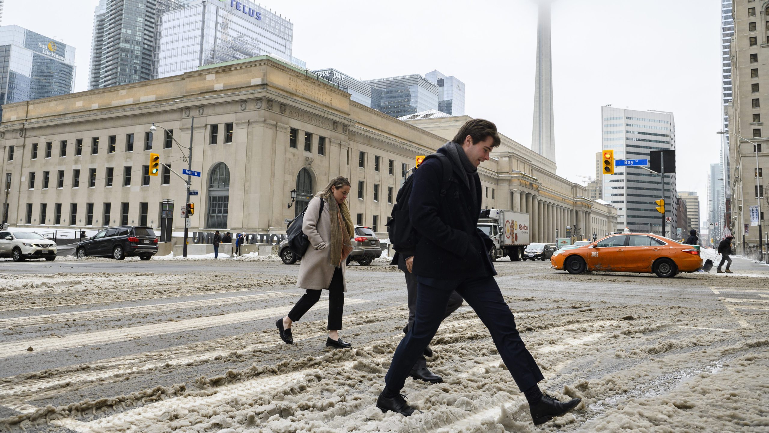
Land and air travel are likely to face notable disruptions with the high snowfall totals forecasted for Toronto and the GTA.
Dozens of departing and arriving flights at Toronto Pearson International Airport have been delayed or cancelled due to snow storm. Airport officials are advising travellers to check their flight status before leaving for the airport.
“Our teams will be working around the clock to clear snow from runways, taxiways, and aprons to ensure safe arrivals and departures,” the airport said in a social media post.
Weekend snowstorm possible for Toronto, GTA
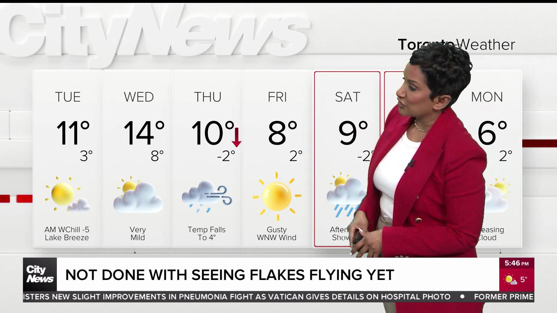
Toronto and GTA residents will get a temporary break on Friday, but another winter storm could impact the region over the weekend. A Colorado low is forecast to track just south of the area, bringing widespread snowfall to southern Ontario on Saturday.
Though subject to change, snow is forecasted to fall early Saturday morning, with 8 cm possible by the afternoon. In the evening hours, additional accumulations of 5 cm could be observed, with snow tapering off overnight.
Saturday’s daytime high is forecasted to be -2 C, though it will feel closer to -5 with the wind chill in Toronto.
Toronto was blasted with the season’s heaviest snowfall on Saturday, Feb. 8, with 13 cm falling downtown and 15 cm recorded at Pearson International Airport — the most this winter.
Click here to sign up for the CityNews Weather Guarantee and to check out Toronto’s extended forecast.