Wintry, messy weather hits Toronto and GTA on Wednesday
Posted April 2, 2025 6:42 am.
Last Updated April 2, 2025 9:25 pm.
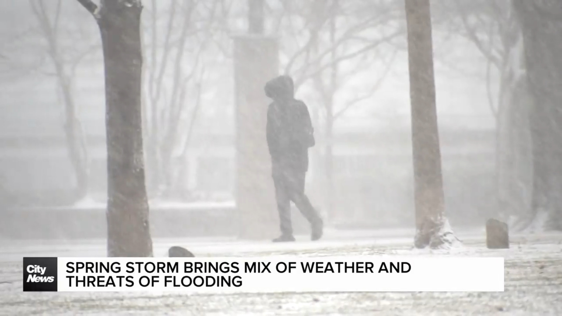
With some areas of the province still feeling the effects of a potent storm that resulted in widespread power outages, another wintry system has made its way to Ontario, leaving a trail of snow, freezing rain and rain.
As of Wednesday, much of the province was under weather warnings and watches, with a rainfall warning in place for Toronto. A freezing rain warning has ended for much of southern Ontario.
Toronto and the GTA are bracing for heavy rainfall, raising concerns about localized flooding. Some areas could see up to 50 mm of rain, with a chance of strong thunderstorms developing in the southwest.
“Heavy downpours can cause flash floods and water pooling on roads,” Environment Canada said.
Communities still recovering from the weekend’s ice storm—including Barrie, Orillia, Peterborough, Bancroft, and Kingston—face another round of wintry weather.
Power utility Hydro One says crews have been working around the clock since the last storm blew through, knocking out power to hundreds of thousands of homes.
As of 4 p.m. Thursday, nearly 190,000 of the over 1 million who faced outages were still without power with crews working around the clock to restore it.
Hydro One said this was the most devastating and widespread damage Ontario has faced since the ice storm in 1998.
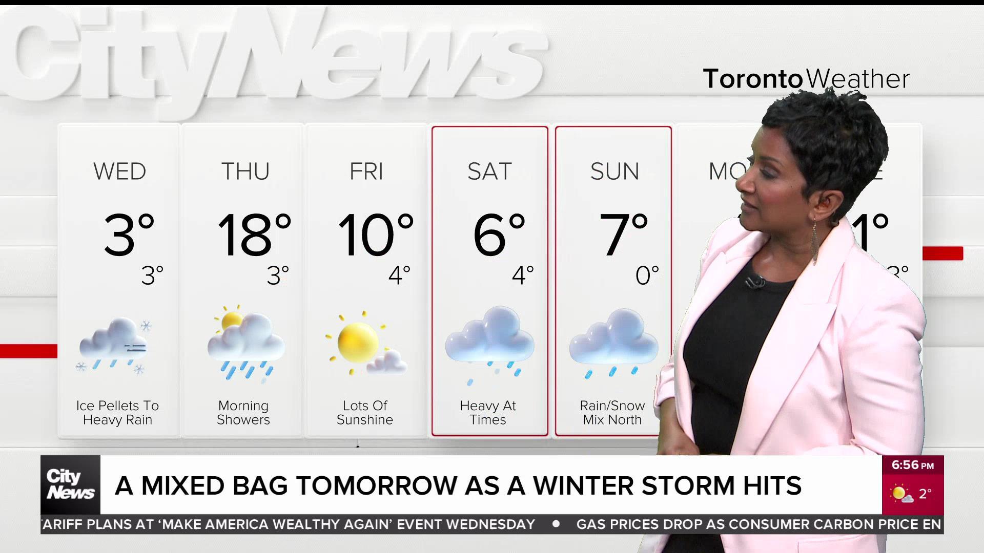
Toronto’s weather timeline
Light snow arrived in Toronto around 1 p.m. before switching over to ice pellets and freezing rain.
“Surfaces such as highways, roads, walkways and parking lots may become icy, slippery and hazardous,” Environment Canada said.
Light to moderate rainfall is then forecasted for the evening hours before becoming heavy by midnight and into the overnight, with 4 mm of rain per hour between 1 a.m. and 4 a.m. The wet weather will gradually taper off ahead of Thursday’s morning commute, paving the way for a mix of sun and clouds.
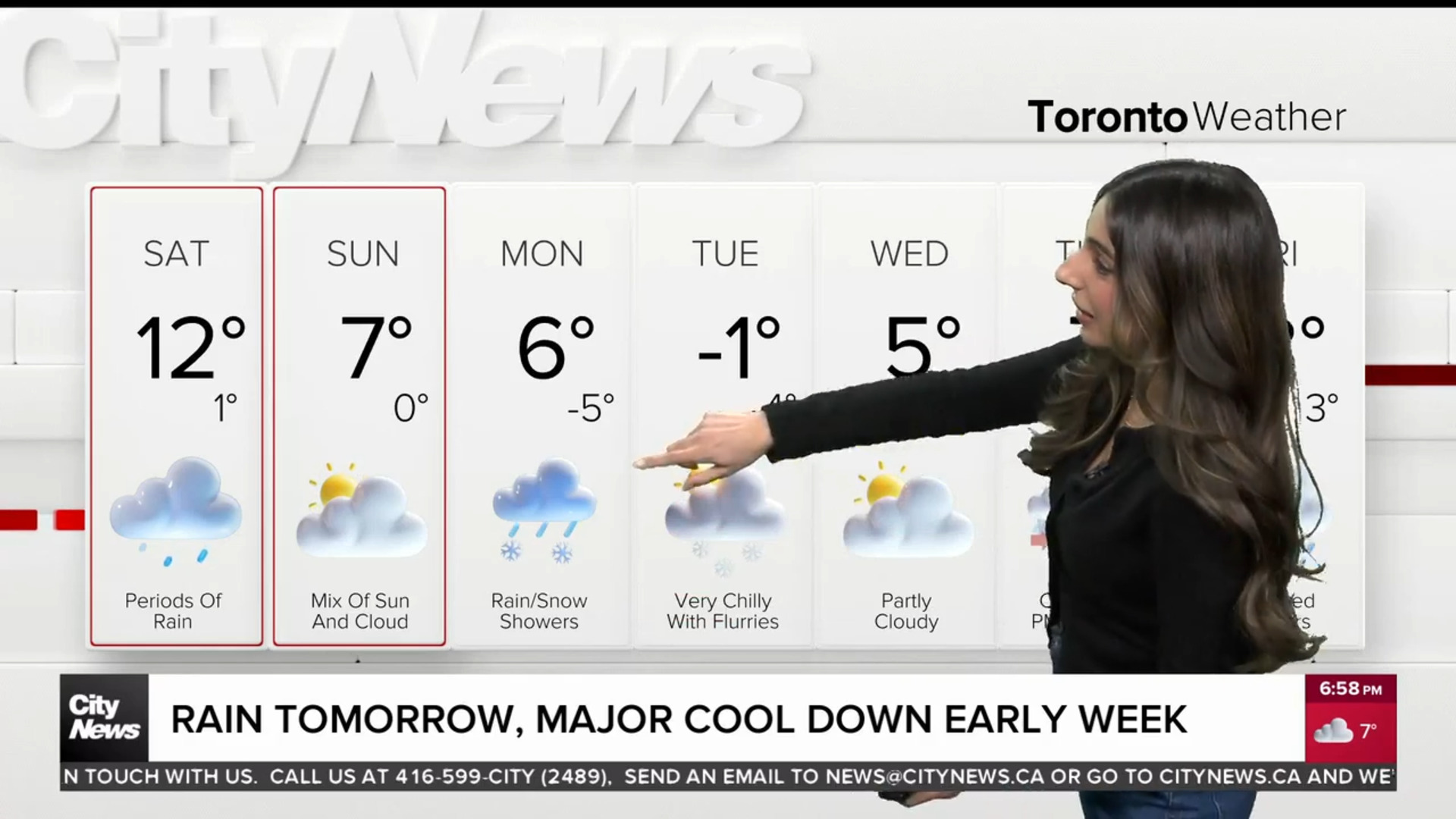
The messy round of weather will increase daytime temperatures for Thursday in Toronto. By tomorrow morning, it will have reached 12 C and is forecasted to rise to 17 C for the high. While Friday will be cooler, it’s shaping up to be a pleasant day to cap off the week, with mainly sunny skies and a daytime high of 10 C.
Click here to sign up for the CityNews Weather Guarantee and to observe details on the extended forecast.