Freezing rain warning in effect across Greater Toronto Area, ice accretion possible
Posted January 5, 2026 6:05 pm.
Last Updated January 6, 2026 3:02 pm.
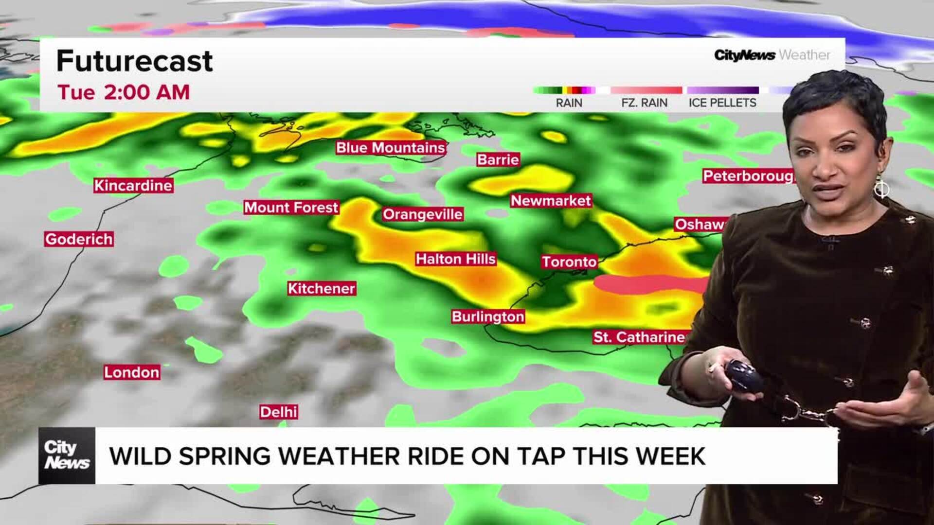
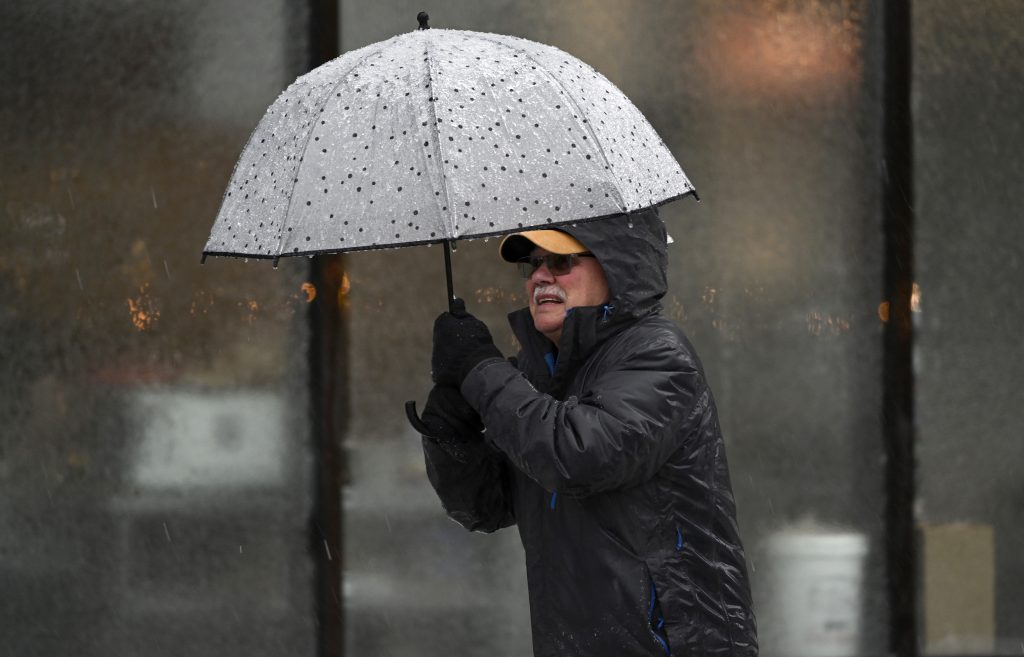
As the afternoon rush hour commute begins across the Greater Toronto Area, a yellow-coloured freezing rain warning issued by Environment and Climate Change Canada (ECCC) remains in effect for much of the region.
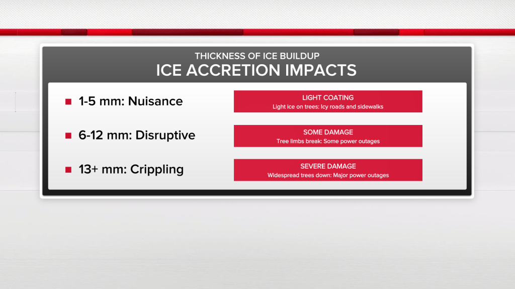
The freezing rain began midday and meteorologists say one to five millimetres of ice accretion is possible in parts of the GTA before the system tapers off early this evening.
Greater ice build-up is expected in areas that are at higher elevations, but closer to Lake Ontario it will be less likely as rain is expected to be in the mix.
ECCC warned that untreated surfaces could quickly become icy and hazardous as temperatures hover near the freezing mark.
“Local utility outages are possible. There is risk of injury due to slips and falls.”
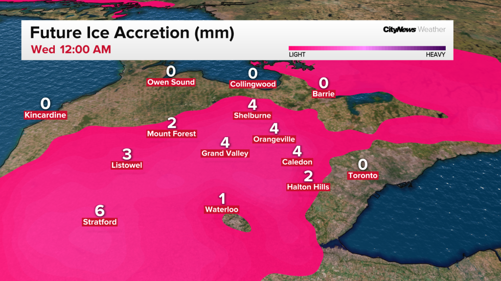
“Freezing rain, which may be mixed with snow or ice pellets at times, is expected to change over to rain or snow as an area of low pressure moves through southern Ontario. Areas near the Lake Ontario shoreline may see very little ice accretion or build up,” the agency warned.
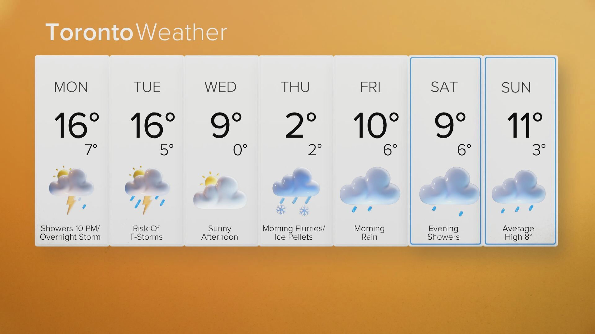
Several GTA school boards cancelled buses earlier on Tuesday due to inclement weather.
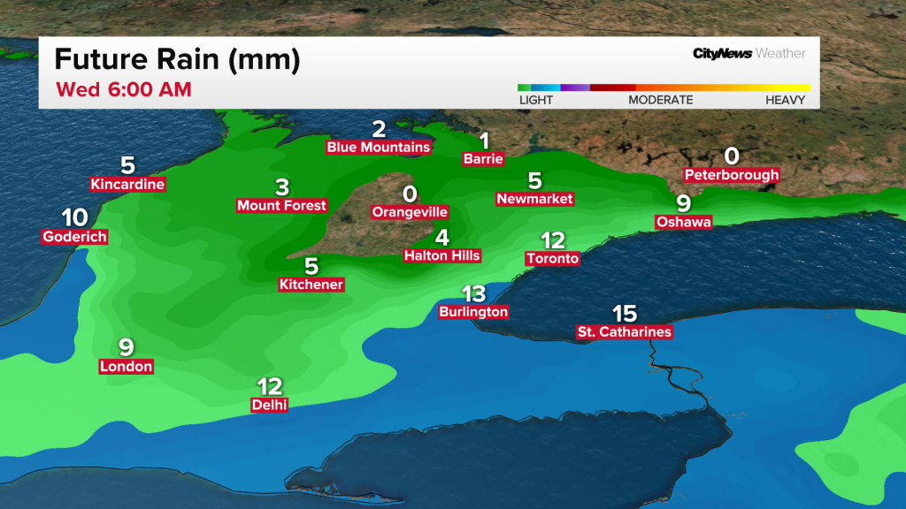
Beginning this evening and into tonight, scattered flurries are expected with a low around 1 C. Most of the GTA should see snowfall amounts up to two centimetres, but communities in the northern end of the region could see up to five centimetres.
Wednesday brings mostly cloudy skies with a few sunny breaks and the chance of flurries along with lighter west winds and a high of 2 C. By Thursday, a mix of sun and cloud is expected with increasing cloud cover late in the day and rain arriving overnight. The forecast high is 4 C.
Click here to sign up for the CityNews Weather Guarantee and to check out Toronto’s extended forecast.