Extreme cold warning lifted for Toronto, GTA
Posted February 12, 2016 11:16 am.
Last Updated February 14, 2016 7:05 pm.
This article is more than 5 years old.
Environment Canada has ended an extreme cold warning for Toronto and the Greater Toronto Area.
The warning, which was first issued on Friday, was lifted on Sunday afternoon.
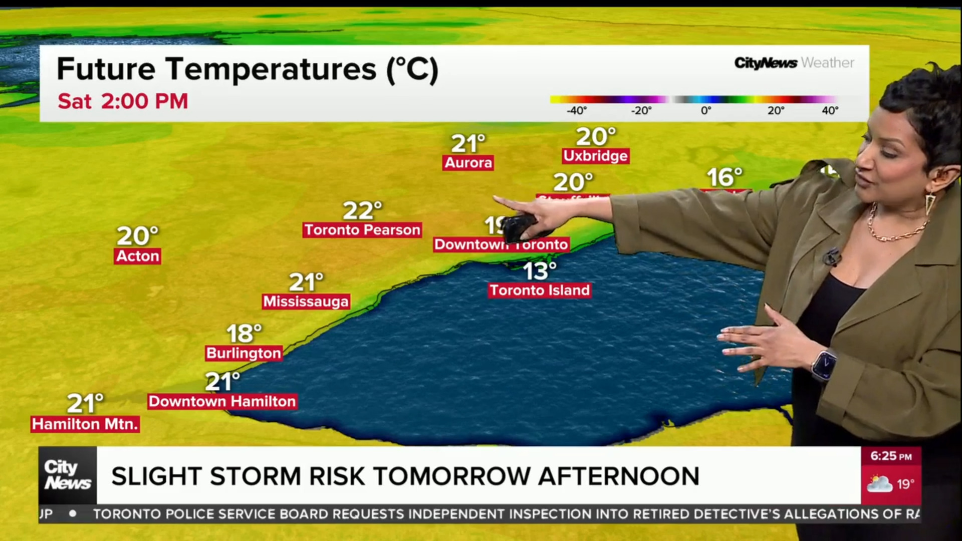
Temperatures are expected to rise after midnight, with mainly sunny conditions throughout the day on Sunday and a high of -11 C.
A cold front had passed through the GTA on Friday night making Feb. 13th the coldest Feb. 13 ever at -26, the previous record was -23.2 in 1994. The coldest February day was on Feb. 15, 1943 at -31.1.
The agency said there was a risk of frostbite in 10 minutes if not properly dressed due to the bone-chilling temperatures on Saturday morning.
The bitterly cold arctic air invaded southern Ontario, bringing extreme wind chills of -30 to -40 and the lowest temperatures of the winter season so far.
Here’s a look at what the weather was like before the warm-up:
If it feels like it hasn’t been this cold in a while, that’s because it hasn’t.
The last time the city saw temperatures this cold was in February of last year.
In fact, CityNews meteorologist Adam Stiles says it’s possible Toronto could break some daily cold records this weekend.
The cold record for Feb. 13 was set in 1979 with the mercury dipping to -23.2 C. The record for Valentine’s Day was set over 70 years ago at a chilly -23.3 C. Now that’s weather you can snuggle to.
Stiles says the lack of ice on the Great Lakes makes this cold snap a bit more impressive.
“When the lakes are frozen it does impact the air travelling over them…it is more like a land mass. With the lake not being covered, the air temperature is going to be moderated by the heat that is radiating from the body of water,” he explained. “Basically this cold air would be colder if the lakes were frozen.”
Stiles adds that photographers might want to get their cameras ready as the dipping temperatures could cause the lakes to steam.
Environment Canada also issued extreme cold warnings for provinces from Manitoba to New Brunswick on Saturday as well.
The national weather forecaster says temperatures could fall to -45 C in Ottawa today with the wind chill, warming up to -35 C overnight.
In New Brunswick, temperatures are expected to hover between -35 C and -40 C with the wind chill until Sunday.
Quebec and Manitoba can expect much of the same, with temperatures warming up early next week.
Meanwhile, Newfoundland is bracing for a winter storm that could bring up to 20 centimetres of snow to eastern parts of the island today.