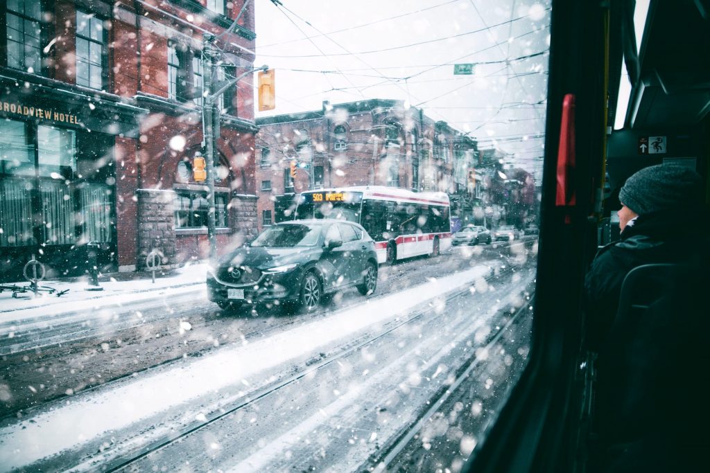
Up to 40cm of snow expected as winter storm hits Toronto, GTA
Posted January 14, 2022 6:54 am.
Last Updated January 17, 2022 8:48 am.
The CityNews Extreme Weather Centre is open and a full list of cancelled buses and school closures can be found here.
A snowfall warning remains in effect for Toronto and the GTA as significant snowfall that began on Sunday night continues throughout most of the day on Monday.
Environment Canada has updated the warning calling for up to 40cm of snow are expected to fall by Monday night with peak snowfall rates of 4 to 7 cm per hour through the morning.
Up to 30cm was already on the ground in some parts of the city by 7 a.m.
Getting close to the one day record snowfall for January! The record one day snowfall for January is 36.8cm on Jan. 23, 1966. The record for a Jan. 17 has been shattered. That record was 7.6cm set in 1994@CityNewsTO
— Jill Taylor (@JillTaylorCity) January 17, 2022
“Heavy snow will likely significantly impact the Monday morning commute,” the national weather service warned. “Local blowing snow is also possible Monday afternoon and evening with gusty northerly to northwesterly winds.”
Strong northwesterly winds gusting up to 50 km/h will result in areas of poor visibility due to blowing snow. The snow is expected to come to an end sometime by the early evening.
This will be your worst drive in a long time. Heavy snowfall is making roads/hiways slippery/slow. Hills also very slippery like this one on Browns Line in west end-cars struggling to get up. Toronto & GTA expecting up to 35 cms of snow. Listen to Citynews680 on 1’s for updates pic.twitter.com/PuXi2DKUN6
— carl hanstke (@carlCityNews) January 17, 2022
The TTC is reporting that all bus and streetcar routes are being affected by the snow on the roads with long than normal travel times. Metrolinx is advising most of its GO buses are experiencing delays of up to 45 minutes.
Anyone flying out of Pearson International Airport is being advised to check their flight times before heading to the airport with several flights being postponed due to the severe weather.
Heads up travellers – there’s 15-20cm of snow for Southern Ontario in the forecast starting tonight into tomorrow morning. Please check your flight status with your airline or on our website before heading to the airport, and remember to drive safe! pic.twitter.com/MWlJ0Im0yo
— Toronto Pearson (@TorontoPearson) January 17, 2022
RELATED: Winter storm delays return to class for GTA students
While the City of Toronto has reissued its extreme cold weather alert, several warming centres will remain open for vulnerable residents.
Four warming centres are located at 129 Peter Street, 5800 Yonge Street, Exhibition Place and Scarborough Civic Centre.