Biting wind chill to make for coldest day of the season so far in Toronto, GTA
Posted November 28, 2023 7:18 am.
Last Updated November 28, 2023 11:21 am.
GTA residents who’ve held out on unpacking the winter gear will need to finally break out the toques, mittens and parkas on what will likely be the coldest day of the season so far.
The temperature is not expected to rise above the freezing mark in Toronto, and areas north and northwest of the city are in for another round of significant snow.
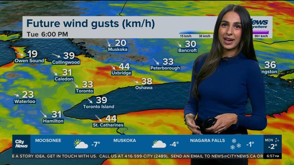
“You definitely need the extra, extra layers,” says CityNews 680 meteorologist Jill Taylor. “Strong winds out of the west, northwest today.”
It’s already the coldest morning this fall so far if you factor in the wind, feeling like -12 in the early morning hours. The actual temperature at Pearson Airport as of 5 a.m. was -5.4 C.
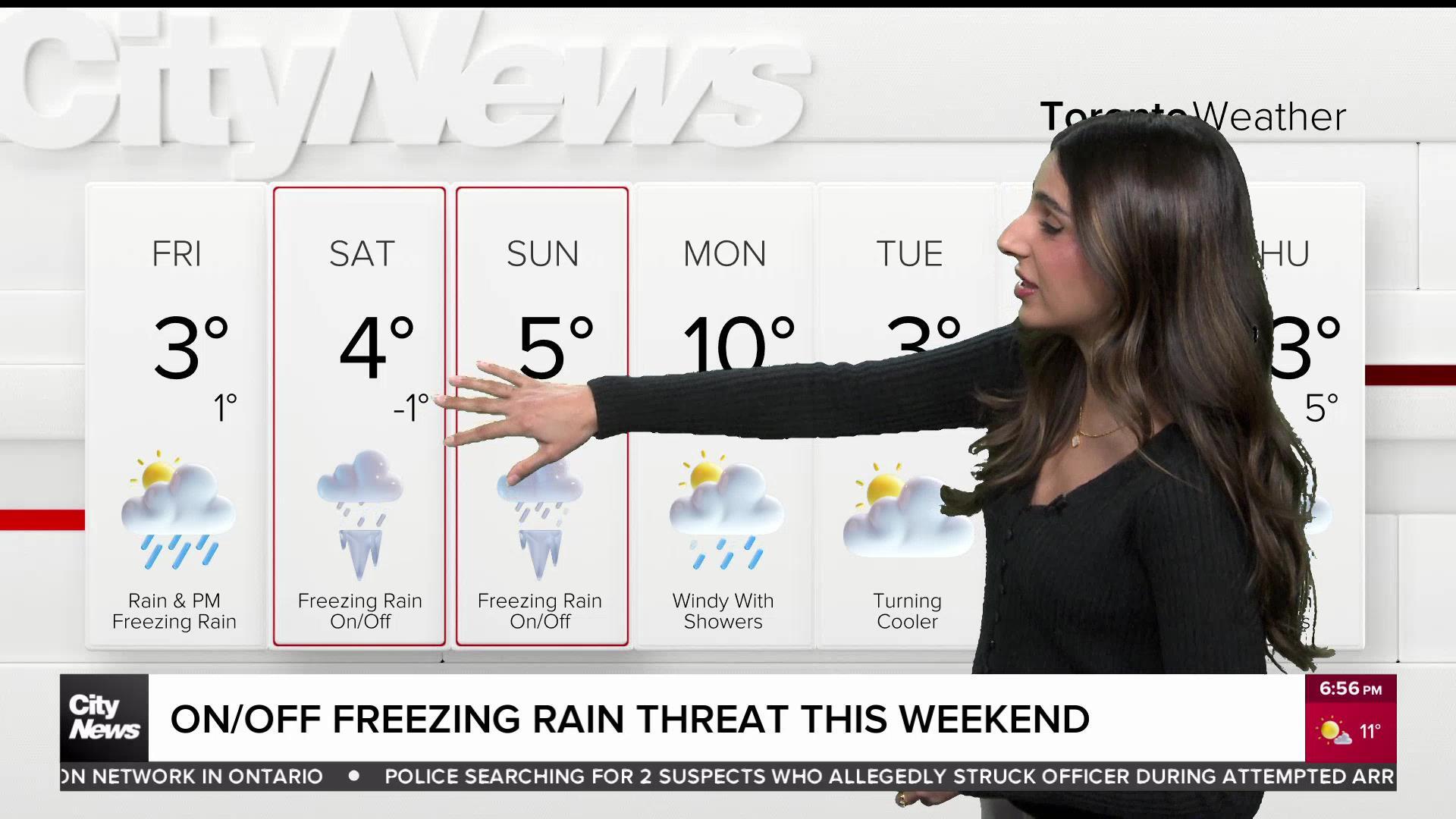
The guaranteed high for Toronto on Tuesday is -1 C. The city hasn’t had a high in the minus since March 14.
It’s a cold Tuesday morning! Dress for a wind chill near -12 now and near -9 this afternoon. The Guaranteed High today is just -1°C! Snow Squall Warning continues for Newmarket, Georgina & Uxbridge and west end GTA could even get a quick burst of accumulating snow
— Jill Taylor (@JillTaylorCity) November 28, 2023

Taylor says the west end of the GTA could see a quick burst of lake-effect snow on Tuesday, possibly collecting one or two centimetres. A winter weather travel advisory has been issued for the City of Hamilton, Burlington, Oakville, Halton Hills, Milton and southern Durham Region, including Pickering and Oshawa.
“Strong winds may accompany these snow bands resulting in significantly reduced visibility at times in heavy snow and blowing snow,” reads the advisory for Durham. “Portions of Highway 401 will be affected.”
A snow squall warning remains in effect for the northern parts of the GTA, including Newmarket, Georgina, Uxbridge and Beaverton.
“Lake-effect snow squalls are forecast to move into the area this morning,” reads the warning from Environment Canada. “These snow squalls will continue through the day before weakening tonight.”
The weather agency warns of snowfall accumulations of up to 20 centimetres in affected areas, with up to 30 centimetres possible closer to Georgian Bay. School buses for the Simcoe County District School Board have been cancelled Tuesday.
Environment Canada is advising motorists in the impacted areas to consider postponing non-essential travel, saying visibility could be reduced suddenly.
The GTA will see another cold morning on Wednesday, a high of 1 C is expected, with another round of snow squalls in the forecast. Taylor says Toronto could see a light dusting of snow on Wednesday morning when winds shift to the southwest.
Seasonal highs are expected to return on Thursday and Friday with rain and snow possible on the weekend. The extended forecast for Toronto can be found here.
Going by the actual temperature, Toronto actually saw a chillier morning this season on Nov. 20, but the wind chill wasn’t as much of a factor on that day.