Snow, heavy rain hits Toronto and GTA with another potential system on the way
Posted January 8, 2024 7:52 am.
Last Updated January 9, 2024 8:55 pm.
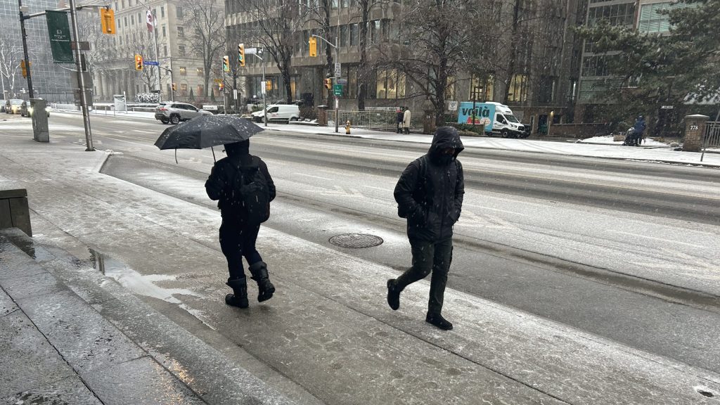
Days after getting the first significant snow of the season, Toronto was hit with a messy winter storm Tuesday that impacted the drive home on the first week back to work or school for many.
A winter weather travel advisory was in place for Toronto for much of the day as snow began falling in the late morning. A rainfall warning is now in effect, with Environment Canada calling for heavy rain that will persist overnight.
Environment Canada says the City of Toronto and areas closer to the lake received roughly 5 to 10 cm of snow, with areas further north seeing up to 15 cm.
The rainfall warning that called for 20 to 35 millimetres for the city started in the afternoon and melted much of the snow. Areas closer to the lake moved away from the snow and are expected to see the most rain.
“Significant rainfall is expected. The frozen ground has a reduced ability to absorb [it],” Environment Canada wrote in its weather alert. “Localized flooding in low-lying areas is possible. Heavy downpours can cause flash floods and water pooling on roads.”
CityNews chief meteorologist Natasha Ramsahai said the heaviest wet snow fell in the early afternoon until around 2 p.m. when it started to transition to heavier rain.
“There is a risk of thunderstorms as we head into the late afternoon and early evening,” Ramsahai added.
The wet weather should transition to flurries on Wednesday as temperatures slightly cool overnight. A high of 4 C is expected mid-day tomorrow.
Some light snow could return on Thursday as morning temperatures hover around the freezing mark. Another winter storm that brings more snow accumulation could arrive on Friday night in time for the weekend, but it’s too early to forecast snow totals.
CLICK HERE TO LISTEN TO LIVE WEATHER COVERAGE!Drivers forced to deal with slushy evening commute
OPP Sgt. Kerry Schmidt reminded drivers on Tuesday to use common sense before they got behind the wheel.
“As this system continues to swallow southern Ontario, it is probably going to get more messy,” Schmidt said in the afternoon, warning of the possibility of ponding in some areas.
“We’re asking drivers to turn on your full head lighting system and give yourself space and time. Be aware of your surroundings.”
He said police dealt with dozens of collisions on GTA highways through the afternoon.
The City of Toronto was monitoring roadways, and crews are prepared to deploy should they be required. The city said salting operations begin when snow begins to stick on the roads.
Plows are activated if the snow reaches 2.5 cm on expressways, 5 cm on major roads, and 8 cm on residential streets. Residents can track the city’s plows and salt trucks on this map.
Some school buses were cancelled for the day in the northwest part of the GTA, including Caledon, Halton Hills, Georgetown and Action. A full list of bus cancellations can be found here.

Toronto is opening its four warming centres as of 5 p.m. Tuesday. The centres provide resting spaces, meals, washroom access, and emergency shelter referrals.
The city saw its first significant snowfall of the season over the weekend, with most areas collecting around five centimetres. A relatively dry December saw Toronto collect 13 cm of snow compared to 30 cm a year ago.
The current conditions and extended forecast for Toronto can be found here.