Environment Canada says extreme heat is continuing Wednesday in Ontario, Quebec
Posted June 19, 2024 4:00 am.
Last Updated June 19, 2024 5:01 pm.
Central and southern Ontario and much of western Quebec are forecast to experience another day of sweltering weather.
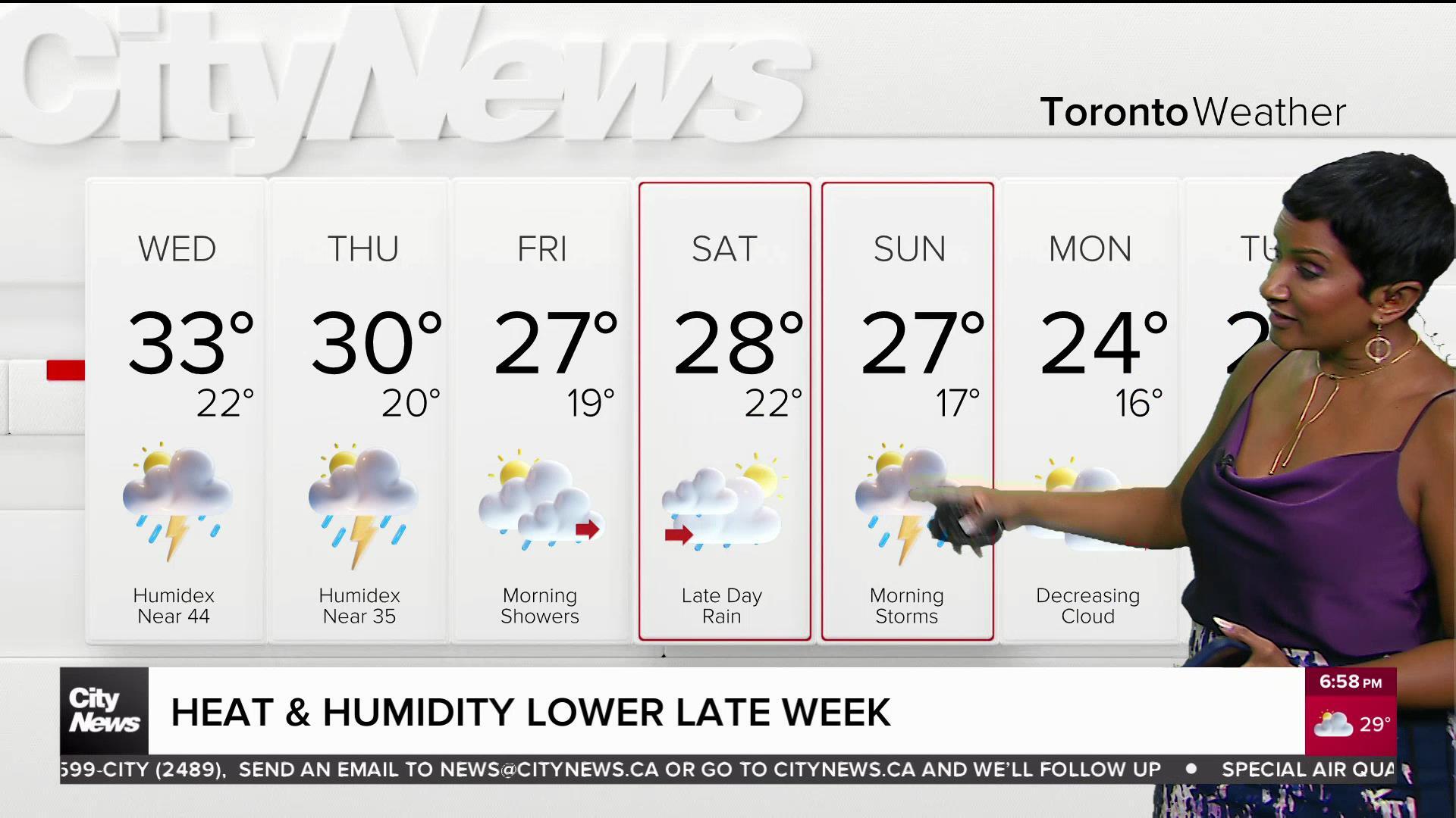
Environment Canada’s heat warnings say daytime highs are expected to hit 30 to 35 C, with the humidex making it feel closer to 40 on Wednesday. And while the daytime hours are expected to be steamy, there may be some relief during the overnights.
“A prolonged heat event continues through Friday or Saturday. Dangerously hot and humid conditions are expected,” the alert reads in Toronto.
The agency says the lows can vary between 18 to 23 C. However, any benefit from the roughly 10-degree difference could very well be lost when factoring in humidex values of 26 to 30.
A special air quality statement was issued in Toronto and the surrounding GTA on Tuesday, hours after a cluster of strong thunderstorms and heavy rain popped up in the city.
“Hot and humid air can also bring deteriorating air quality and can result in the Air Quality Health Index approaching the high-risk category,” Environment Canada wrote in a statement.
“The health risks are greater for older adults, infants and young children, pregnant people, people with physical and/or mental illnesses, and people with disabilities or mobility issues. Never leave people, particularly children or pets, inside a parked vehicle.”
For details on the extended forecast and to sign up for the CityNews Weather Guarantee, click here.
With files from The Canadian Press