Toronto’s spring-like warmth holds for one more day before temperature drop

Posted March 11, 2025 6:06 am.
Last Updated March 11, 2025 6:10 am.
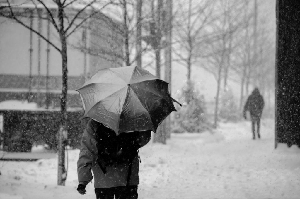
The spring-like stretch experienced in Toronto and the GTA will continue for one more day before temperatures plummet on Wednesday, but not before what’s shaping up to be a welcome period of sunshine.
Temperatures reached 11 C on Monday, the first double-digit high recorded at Toronto Pearson since Dec. 29, 2024, as sunny skies dominated the start of the week.
Toronto is beginning to recover from a sun-starved winter, and this week could potentially deliver the longest stretch of primarily clear skies since October 2024.
It’s been almost five months since the city has seen this much sunshine. The last stretch of predominantly clear skies occurred from Oct. 16 to 22.
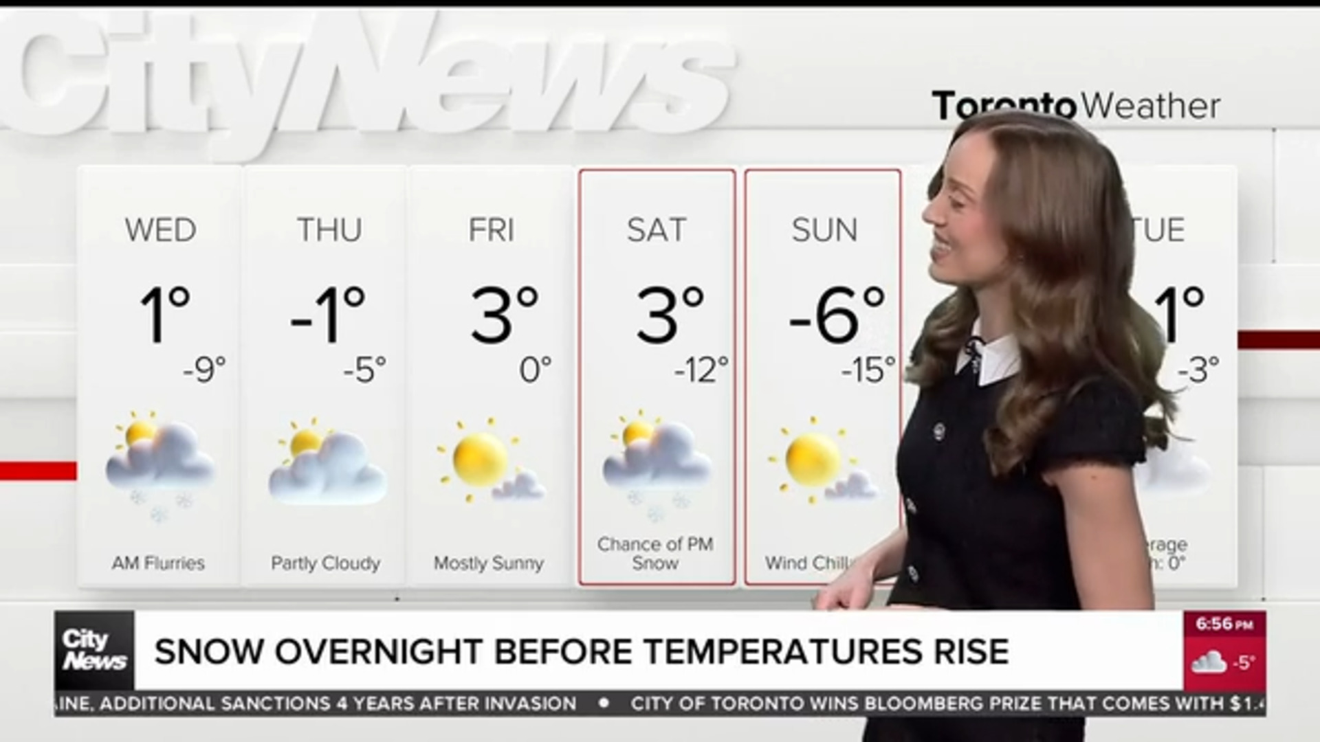
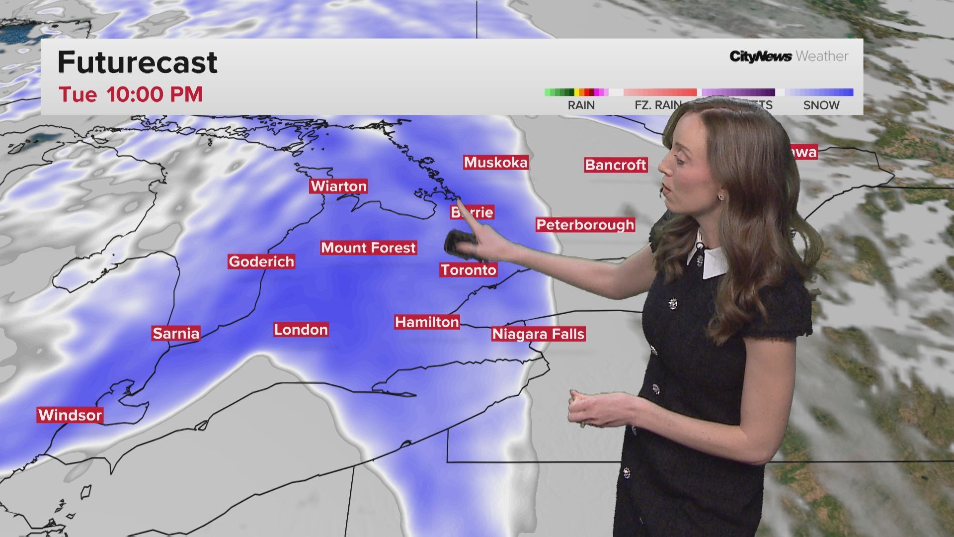
The pleasant temperature trend will continue today, with a forecasted daytime high of 8 C in Toronto. But by the afternoon, a cold front will move in and bring a cooldown and cloud cover, clearing out by the evening.
Another warm-up is on the way, despite blip and dip on Wednesday
The winter temperatures will return by Wednesday, with a forecasted -4 C to start the day, though it will feel more like -10 in the morning. It will warm slightly by the afternoon at -1 C with a mix of sun and clouds.
After Wednesday, it starts to look more promising, with a forecasted daytime high of 6 C in Toronto on Thursday with a mix of sun and clouds, followed by a forecasted high of 10 C on Friday.
Temperatures could soar to as high as 12 C by the weekend’s arrival, but a tracked system could bring significant rain, leading to a weekend washout on Saturday and Sunday.
Click here to sign up for the CityNews Weather Guarantee and to observe the extended forecast.