‘Potent spring ice storm’ possible for Toronto, GTA starting Friday, Environment Canada says
Posted March 26, 2025 2:40 pm.
Last Updated March 27, 2025 10:01 am.
Environment Canada has issued a special weather statement for Toronto and the GTA, calling for a possible “potent spring ice storm” starting late Friday and into Monday of next week.
“Confidence is increasing in a widespread, prolonged freezing rain event over portions of southern and northeastern Ontario,” the national weather agency said in issuing the statement on Wednesday.
“The swath of maximum ice accretion is still uncertain at this point, but confidence is highest for areas of central and eastern Ontario between Parry Sound and Kingston. Warnings will be issued as the event draws nearer.”
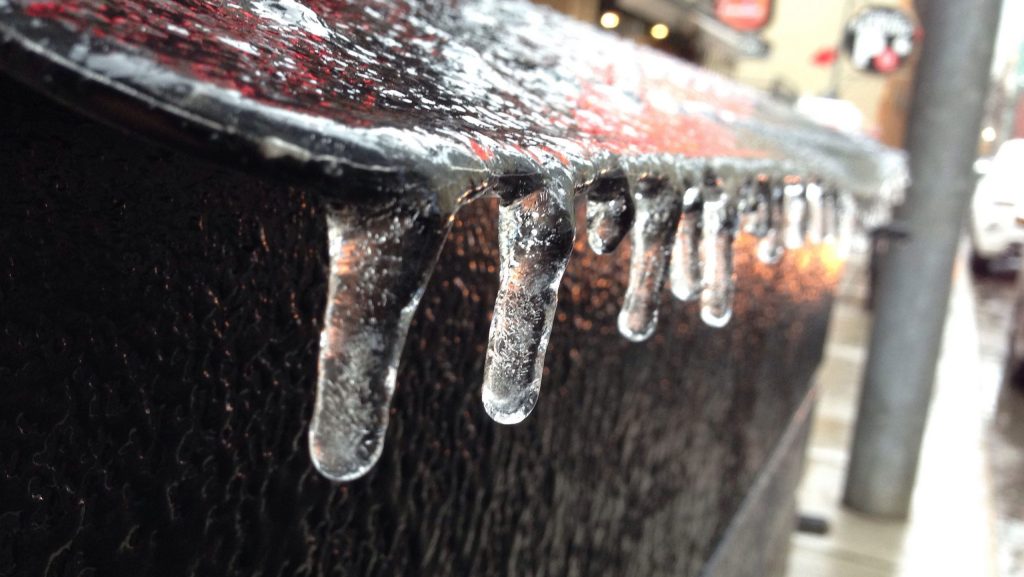
Environment Canada said significant ice accretion from freezing rain, up to 15 millimetres, is possible, with more than 20 millimetres over some areas.
There is also the potential for local snowfall and ice pellet accumulations of 5 to 15 centimetres for central and northeastern Ontario.
The national weather agency warns of possible power outages as well as broken tree branches from the ice build-up.
Four-day storm system arrives on Friday
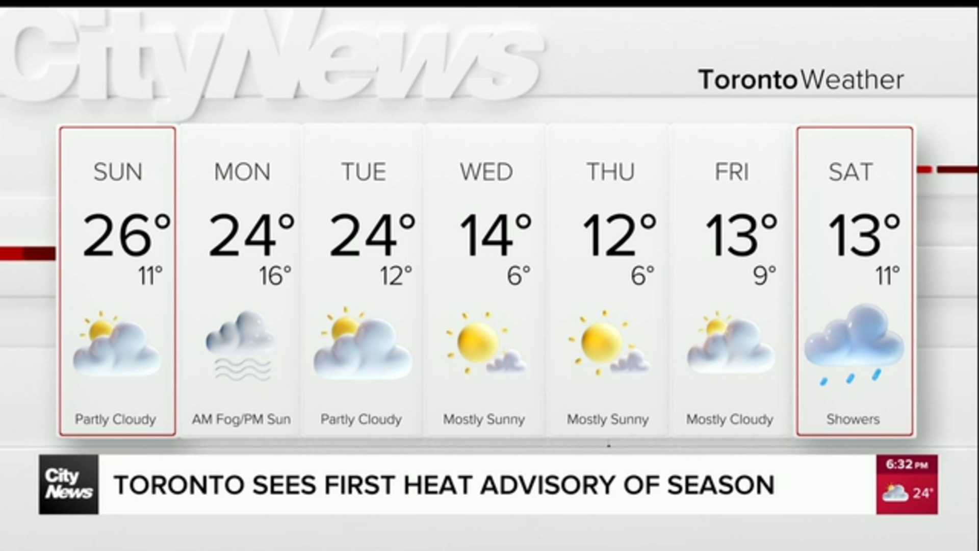
The freezing rain could arrive in Toronto and the GTA by Friday evening. Showers start in the afternoon and then switches over to rain in the evening with the potential for freezing rain.
Rain will continue on Saturday with possible freezing rain to the north and east of the region, especially in cottage country and eastern Ontario. In the GTA, periods of rain continue on Sunday with potential freezing rain, and Monday appears to be mainly rain.
According to 680 NewsRadio and CityNews meteorologists, the freezing rain will come in waves from Friday to Monday and will mix with rain for the Toronto area.
“We could be looking at 24-30 hours on-and-off of freezing rain through the weekend,” chief meteorologist Natasha Ramsahai said.
The storm system will be also be temperature dependent, 680 NewsRadio meteorologist Jill Taylor said. So far, the morning lows are “near or just above freezing for [the] Toronto area and may stay as all rain for Toronto.”
Toronto and the GTA could see about five millimetres of ice accretion over the four-day period while north GTA could get 15 millmetres of accretion.
Parry Sound, Muskoka and areas in central and eastern Ontario could get between 20-40 millimetres of ice accretion.
Potential damage with 5 to 15 millimetres of ice could include broken tree limbs and power outages. Anything more than 15 millimetres could cause major travel issues, major power outages and lots of damage to trees.
In December 2013, an ice storm hit the GTA with more than 30 millimetres of ice accretion and caused large scale power outages. Another icy system moved through the region back in April 2018, but Taylor said it was not as prolonged as the 2013 storm.
Click here for details on the forecast.