Snowfall warning for Toronto and GTA ends, snow squalls expected Wednesday night
Posted January 20, 2026 5:57 am.
Last Updated January 21, 2026 4:08 pm.
A snowfall warning has ended for Toronto and parts of the GTA after a fast‑moving Alberta clipper that was expected to drop 10 centimetres of snow through the day, creating difficult travel conditions for both the morning and evening commutes.
Environment Canada says snow began early Wednesday with periods of heavy snow and local blowing snow reducing visibility.
The system is expected to taper to lighter snow by early evening. Totals of five to 10 centimetres are forecast across the GTA, with the highest amounts in Toronto, areas east of the city, and regions west of the GTA.
Lake‑effect flurries are expected tonight, bringing trace amounts to 2 cm locally. Areas outside the GTA, including the Bruce Peninsula and parts of Georgian Bay, could see up to 40 cm of snow from squalls.
What to expect this week
Behind the clipper, another surge of Arctic air will settle over southern Ontario. Thursday will bring a mix of sun and cloud with a high near –5°C and a low of –12°C.
Friday turns even colder, with a chance of flurries, a high of –10°C, and an overnight low near –20°C. Wind chills could approach –30, raising the risk of frostbite and hypothermia.
The coldest air of the season is expected to arrive early Saturday morning, with temperatures plunging to –25°C and wind chills near –32.
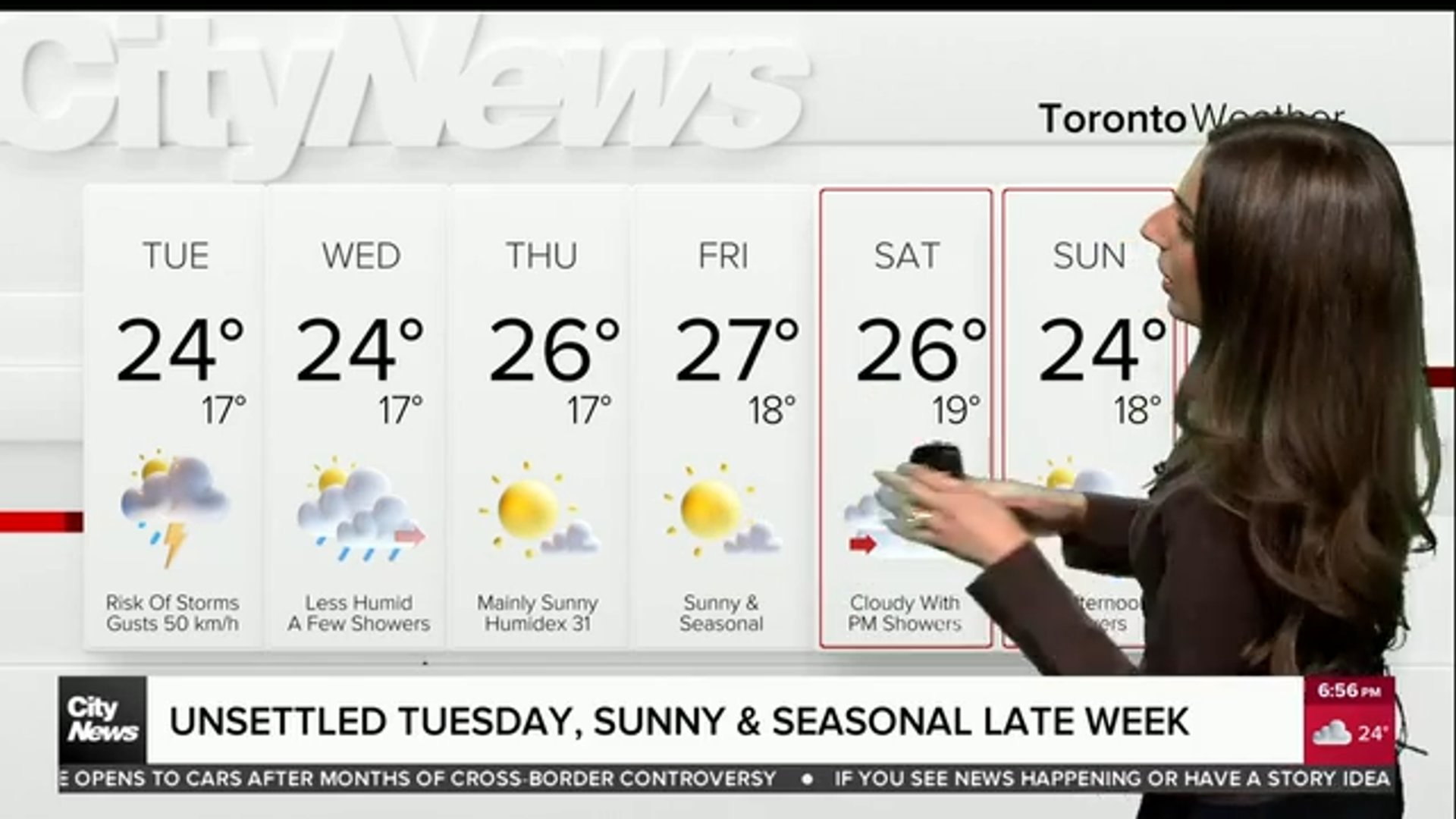
Short‑term forecast (Toronto)
Thursday: Mix of sun and cloud; high –5°C, low –12°C.
Friday: Chance of flurries; high –10°C, low –20°C; wind chills near –30.
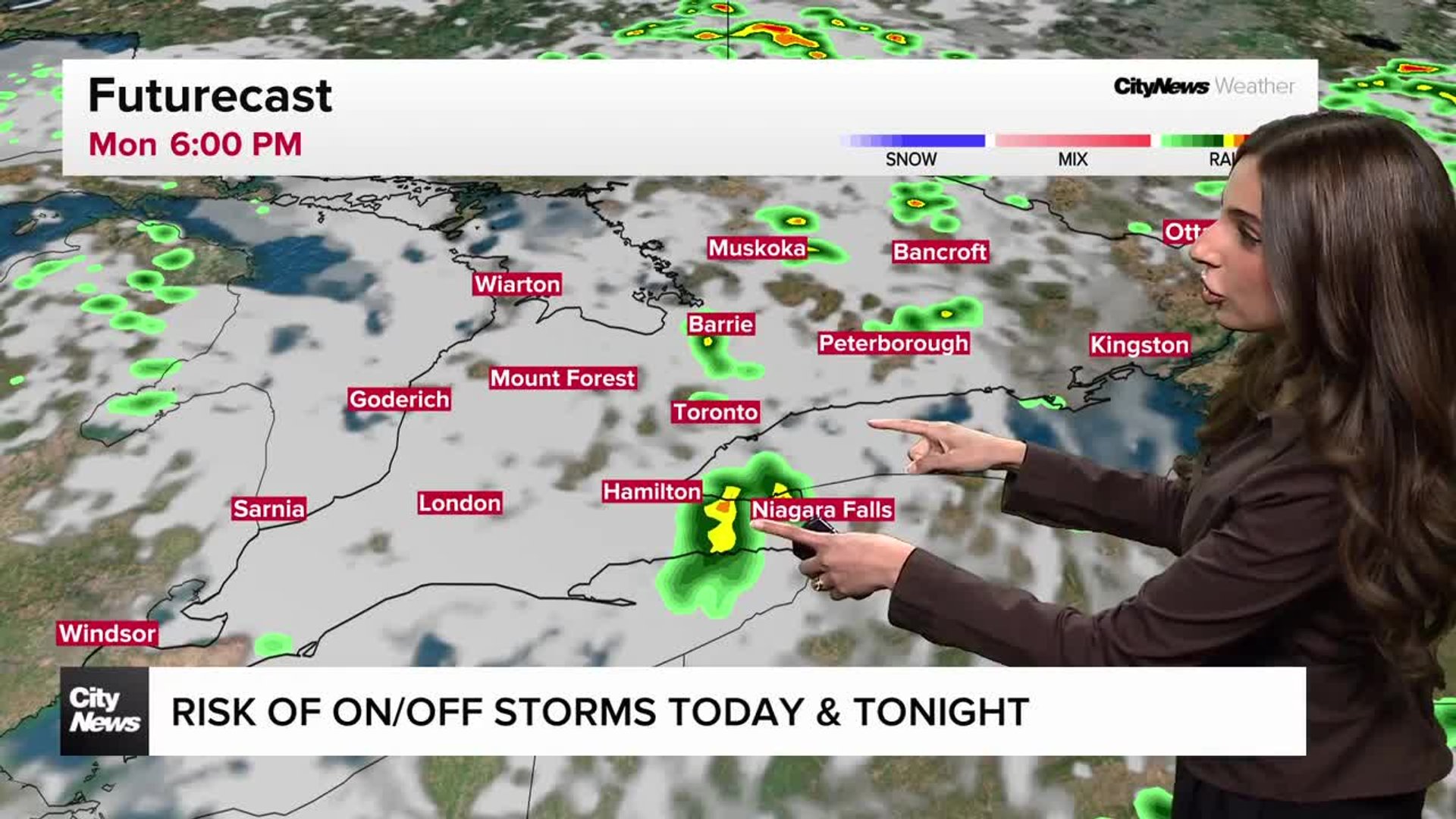
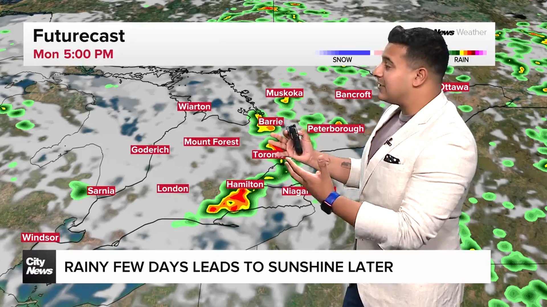
High-impact storm to hit U.S. this weekend
CityNews meteorologist Natasha Ramsahai says a high‑impact winter storm is expected to hit the U.S. South, Southern Plains, Tennessee Valley and Mid‑Atlantic this weekend. While that system will be a major weather maker south of the border, its northern edge is still difficult to pin down.
As of midday Tuesday, two out of three long‑range models show the storm completely missing southern Ontario and the GTA. One model brings the northern edge of the snow into the GTA sometime Saturday night into Sunday morning.
Ramsahai says it will take another 24–48 hours before forecasters have a clearer sense of whether the GTA will see accumulating snow or remain on the quiet northern fringe of the system.
Click here to sign up for the CityNews Weather Guarantee and to check out Toronto’s extended forecast.