Toronto weekend forecast: Cool, rainy Saturday before temperatures surge to 20s next week
Posted May 22, 2026 10:06 am.
Last Updated May 22, 2026 10:52 am.
Toronto is heading into a wet, cool and windy start to the weekend— but a stretch of warmer, spring‑to‑summer temperatures is finally on the way next week.
Friday starts on a bright note, with a mix of sun and cloud and a high of 15°C, though an easterly wind of 20–40 km/h will keep things feeling cooler near the lake. Clouds move in Friday night with a chance of showers and a low of 10°C.
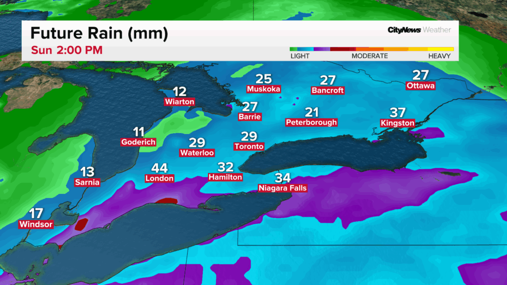
Saturday will be the system to get through. Forecasters expect 20-30 millimetres of rain, steady easterly winds of 30–50 km/h, and a high of just 11°C — well below seasonal norms. The high of 11°C will be reached Saturday morning, with afternoon temperatures hovering around 9°C.
The soggy setup aligns with a broader pattern of unsettled weather across the region. Earlier this week, parts of the northern GTA were under a frost advisory as overnight temperatures dipped close to freezing.
A sharp rebound for Sunday; Stretch of 20‑degree days next week
Sunday brings a turnaround. After some early scattered showers, Toronto could see a few sunny breaks and slightly warmer temperatures, with a high of 16°C and light southwest winds.
Overnight lows rise to 12°C, setting the stage for a much warmer week ahead.
Toronto will finally tap into a more stable, warmer pattern starting Monday, with a forecast mix of sun and cloud, highs in the 20°C range, and lows in the 13°C range. Warmer conditions will be felt on Tuesday, with a high of 24°C and a low 16°C.
These temperatures are closer to late‑May climate normals, which typically range from 20–22°C for daytime highs between May 23 and May 29. Historically, Toronto often sees its first consistent run of 20‑degree days during this final stretch of the month — and this year appears to be following that pattern.
Click here to sign up for the CityNews Weather Guarantee and to check out Toronto’s extended forecast.